Albert Fields
Albert Fields is a hairdresser in Goring, South Oxfordshire District, England which is located on High Street. Albert Fields is situated nearby to Goring Free Church, as well as near the art gallery Reeds Art & Framing.| Tap on a place to explore it |
Places of Interest Nearby
Highlights include Goring Lock and Church of St Thomas of Canterbury.
Goring Lock
Lock

Photo: grumpylumixuser, CC BY 3.0.
Goring Lock is a lock and weir situated on the River Thames in England at the Goring Gap in the Chiltern Hills. The lock is located on the Oxfordshire bank at Goring-On-Thames, with Streatley, Berkshire on the opposite side of the river. Goring Lock is situated 890 feet northwest of Albert Fields.
Church of St Thomas of Canterbury
Church

Photo: Murgatroyd49, CC BY-SA 4.0.
Church of St Thomas of Canterbury is situated 550 feet west of Albert Fields.
Goring & Streatley railway station
Railway station
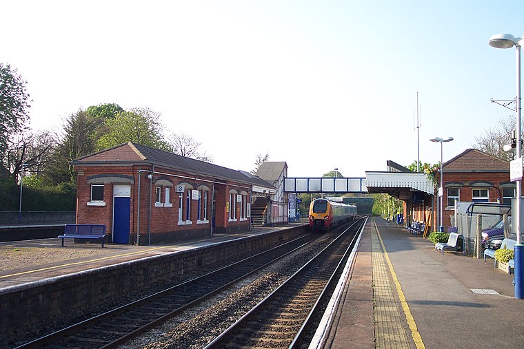
Photo: Chris j wood, CC BY-SA 3.0.
Goring & Streatley railway station is on the Great Western Main Line, serving the twin villages of Goring-on-Thames in Oxfordshire and Streatley in Berkshire. Goring & Streatley railway station is situated 1,200 feet southeast of Albert Fields.
Places in the Area
Nearby places include Goring and Streatley and Streatley.
Goring and Streatley

Photo: Mariegriffiths, CC BY-SA 4.0.
Goring and Streatley are twin villages in the Chilterns Area of Outstanding Natural Beauty on the boundary of Berkshire and Oxfordshire respectively, in England.
Streatley
Village

Photo: Andrew Smith, CC BY-SA 2.0.
Streatley is a village and civil parish on the River Thames in Berkshire, England. The village faces Goring-on-Thames. The two places share in their shops, services, leisure, sports and much of their transport.
Lower Basildon
Village

Photo: Pam Brophy, CC BY-SA 2.0.
Lower Basildon is a small English village in the civil parish of Basildon, near Pangbourne, in the county of Berkshire.
Albert Fields
- Type: Hairdresser
- Address: 8 High Street, RG8 9AU
- Category: shop
- Location: Goring, South Oxfordshire District, Oxfordshire, South East England, England, United Kingdom, Britain and Ireland, Europe
- View on OpenStreetMap
Latitude
51.52259° or 51° 31′ 21″ northLongitude
-1.13767° or 1° 8′ 16″ westOpen location code
9C3WGVF6+2WOpenStreetMap ID
node 1714186812OpenStreetMap feature
shop=hairdresser
This page is based on OpenStreetMap, Wikidata, and Wikimedia Commons.
We’d love your help improving our open data sources. Thank you for contributing.
Satellite Map
Discover Albert Fields from above in high-definition satellite imagery.
Notable Places Nearby
Highlights include Goring Free Church and Reeds Art & Framing.
Nearby Places
Explore places such as Richard Wilson Long and Free Church Hall.
Oxfordshire: Must-Visit Destinations
Delve into Oxford, Abingdon-on-Thames, Banbury, and Woodstock.
Curious Hairdressers to Discover
Uncover intriguing hairdressers from every corner of the globe.
About Mapcarta. Data © OpenStreetMap contributors and available under the Open Database License". Text is available under the CC BY-SA 4.0 license, except for photos, directions, and the map. Photo: Wikimedia, CC0.