Weißes Kreuz
Weißes Kreuz is a wayside shrine in Prellenkirchen, Bruck an der Leitha District, Lower Austria. Weißes Kreuz is situated nearby to the town hall Gemeindeamt Deutsch Haslau, as well as near the wayside shrine Dreifaltigkeitssäule.| Tap on a place to explore it |
Photo: Robert Heilinger, CC BY-SA 3.0.
Places of Interest Nearby
Highlights include Pfarrkirche Deutsch-Haslau and Pfarrkirche St. Markus.
Pfarrkirche Deutsch-Haslau
Church

Photo: Robert Heilinger, CC BY-SA 3.0.
Pfarrkirche Deutsch-Haslau is a church, which is situated 630 metres south of Weißes Kreuz.
Pfarrkirche St. Markus
Church

Photo: Bwag, CC BY-SA 4.0.
Pfarrkirche St. Markus is a church, which is situated 1 km south of Weißes Kreuz.
Dreifaltigkeitssäule
Wayside shrine

Photo: Robert Heilinger, CC BY-SA 3.0.
Dreifaltigkeitssäule is a wayside shrine, which is situated 620 metres south of Weißes Kreuz.
Places in the Area
Nearby places include Deutsch-Haslau and Edelstal.

Edelstal
Village

Photo: Bwag, CC BY-SA 4.0.
Edelstal is a township in the district of Neusiedl am See, in the Austrian state of Burgenland. Edelstal is situated 6 km northeast of Weißes Kreuz.
Rohrau
Village
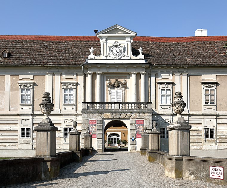
Photo: Bwag, CC BY-SA 4.0.
Rohrau is a village in the state of Lower Austria. The name comes from two German words: Rohr and Au. South of the village is a riparian forest and a swamp covered with reed. Rohrau is situated 6 km west of Weißes Kreuz.
Weißes Kreuz
- Type: Wayside shrine
- Category: historic site
- Location: Prellenkirchen, Bruck an der Leitha District, Lower Austria, Austria, Central Europe, Europe
- View on OpenStreetMap
Latitude
48.05418° or 48° 3′ 15″ northLongitude
16.94027° or 16° 56′ 25″ eastOpen location code
8FWR3W3R+M4OpenStreetMap ID
node 1736004177OpenStreetMap feature
historic=wayside_shrineWikidata ID
Q37772726
This page is based on OpenStreetMap, Wikidata, and Wikimedia Commons.
We’d love your help improving our open data sources. Thank you for contributing.
Satellite Map
Discover Weißes Kreuz from above in high-definition satellite imagery.
In Other Languages
“Weißes Kreuz” goes by many names.
- German: “Bildstock Weißes Kreuz”
Places with the Same Name
Discover other places named “Weißes Kreuz”.
Notable Places Nearby
Highlights include Gemeindeamt Deutsch Haslau and Dreifaltigkeitssäule Potzneusiedl.
Nearby Places
Explore places such as Bayerkreuz and Deutsch-Haslau.
Lower Austria: Must-Visit Destinations
Delve into St. Pölten, Wiener Neustadt, Amstetten, and Klosterneuburg.
Curious Wayside Shrines to Discover
Uncover intriguing wayside shrines from every corner of the globe.
About Mapcarta. Data © OpenStreetMap contributors and available under the Open Database License". Text is available under the CC BY-SA 4.0 license, except for photos, directions, and the map. Photo: Robert Heilinger, CC BY-SA 3.0.