Monte Frombolara
Monte Frombolara is a peak in Carpineti, Reggio Emilia, Emilia-Romagna and has an elevation of 837 metres. Monte Frombolara is situated nearby to the locality Campestrino, as well as near the hamlet La Svolta.| Tap on a place to explore it |
Places of Interest
Highlights include Chiesa di San Donnino and Castello di Felina.


Castello di Carpineti
Castle
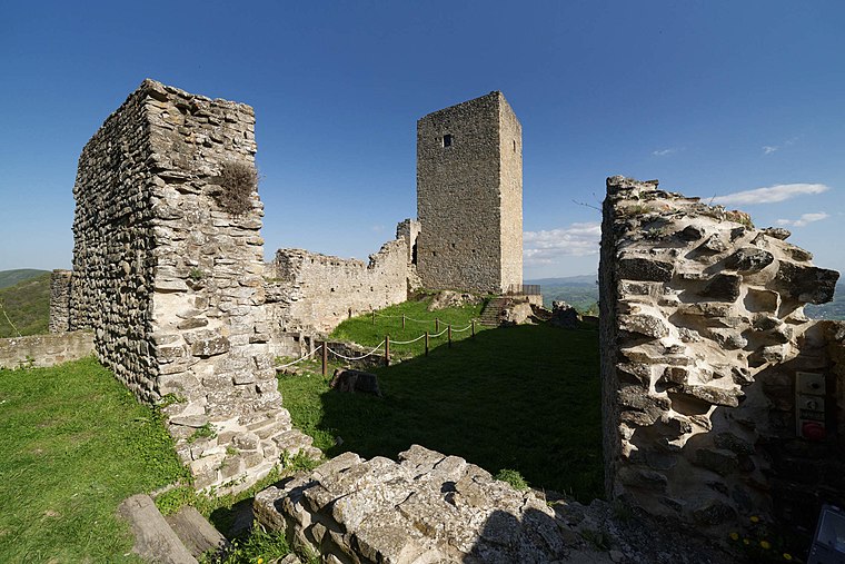
Photo: Basilicofresco, CC BY-SA 4.0.
Castello di Carpineti is a castle.
Places in the Area
Nearby places include Felina and Marola.


Busanella
Hamlet
 Busanella is a hamlet of the Italian Municipality of Carpineti, in the province of Reggio Emilia. The whole frazione, with other small hamlets, is also known as San Biagio, from the name of the parish church, which was a filial church of the pleban church of Carpineti.
Monte Frombolara
- Type: Peak with an elevation of 837 metres
- Category: landform
- Location: Carpineti, Reggio Emilia, Emilia-Romagna, Northeast Italy, Italy, Europe
- View on OpenStreetMap
Latitude
44.4701° or 44° 28′ 13″ northLongitude
10.4801° or 10° 28′ 48″ eastElevation
837 metres (2,746 feet)Open location code
8FPGFFCJ+32OpenStreetMap ID
node 1763708434OpenStreetMap feature
natural=peak
This page is based on OpenStreetMap, Wikidata, and Wikimedia Commons.
We’d love your help improving our open data sources. Thank you for contributing.
Satellite Map
Discover Monte Frombolara from above in high-definition satellite imagery.
Localities in the Area
Explore places such as Frombolara and Campestrino.
Notable Places Nearby
Highlights include Monte Tosco and Oratorio di Pignedolo.
Curious Peaks to Discover
Uncover intriguing peaks from every corner of the globe.
About Mapcarta. Data © OpenStreetMap contributors and available under the Open Database License". Text is available under the CC BY-SA 4.0 license, except for photos, directions, and the map. Photo: Giorgio Galeotti, CC BY-SA 2.0.