Eastry Picnic Site
Eastry Picnic Site is in Eastry, Dover District, England. Eastry Picnic Site is situated nearby to Woodnesborough Football Club, as well as near Eastry Post Office.| Tap on a place to explore it |
Places of Interest Nearby
Highlights include Sandwich railway station and Church of St Peter and St Paul.
Sandwich railway station
Railway station
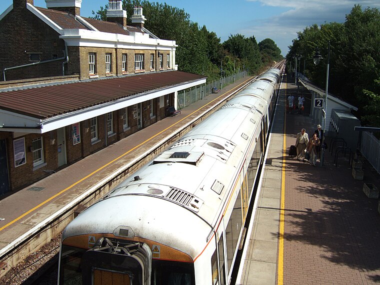
Photo: Edward, CC BY-SA 3.0.
Sandwich railway station serves Sandwich in Kent, England. The station, and all trains serving it, are operated by Southeastern. The station is 8+1⁄4 miles south of Ramsgate on the Kent Coast Line. Sandwich railway station is situated 1½ miles northeast of Eastry Picnic Site.
Church of St Peter and St Paul
Church

Photo: Nick Smith, CC BY-SA 2.0.
Church of St Peter and St Paul is situated 1½ miles east of Eastry Picnic Site.
Sandwich Technology School
School
Sandwich Technology School is a secondary school with academy status in Sandwich, Kent, England. The school motto is 'Hold fast that which is good'. This school was rated by Ofsted as Inadequate and placed in Special Measures in September 2024. Sandwich Technology School is situated 1¼ miles northeast of Eastry Picnic Site.
Places in the Area
Nearby places include Ham and Woodnesborough.
Ham
Hamlet

Photo: Nick Smith, CC BY-SA 2.0.
Ham is a village and former civil parish, now in the parish of Northbourne, in the Dover district, in the county of Kent, England. It is near the town of Sandwich.
Woodnesborough
Village
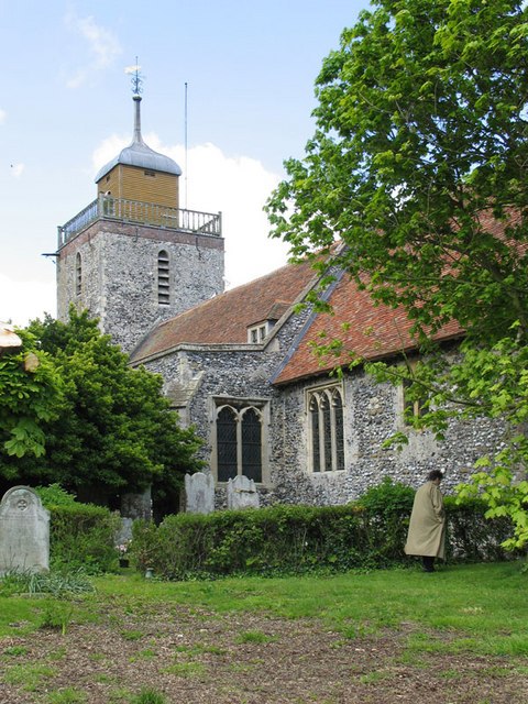
Photo: John Salmon, CC BY-SA 2.0.
Woodnesborough is a village in the Dover District of Kent, England, 2 miles west of Sandwich. The population taken at the 2011 census included Coombe as well as Marshborough, and totalled 1,066.
Marshborough
Hamlet

Photo: Nick Smith, CC BY-SA 2.0.
Marshborough is a small hamlet immediately adjacent to Woodnesborough in East Kent, England.
Eastry Picnic Site
- Type: Sign
- Categories: information and tourism
- Location: Eastry, Dover District, Kent, South East England, England, United Kingdom, Britain and Ireland, Europe
- View on OpenStreetMap
Latitude
51.25202° or 51° 15′ 7″ northLongitude
1.31659° or 1° 18′ 60″ eastOpen location code
9F337828+RJOpenStreetMap ID
node 1767610617OpenStreetMap feature
tourism=information
This page is based on OpenStreetMap, Wikidata, and Wikimedia Commons.
We’d love your help improving our open data sources. Thank you for contributing.
Satellite Map
Discover Eastry Picnic Site from above in high-definition satellite imagery.
Notable Places Nearby
Highlights include Eastry Picnic Site and Woodnesborough Football Club.
Nearby Places
Explore places such as Statenborough Lane and WWII Pillbox.
Kent: Must-Visit Destinations
Delve into Canterbury, Dover, Maidstone, and Rochester.
Curious Places to Discover
Uncover intriguing places from every corner of the globe.
About Mapcarta. Data © OpenStreetMap contributors and available under the Open Database License". Text is available under the CC BY-SA 4.0 license, except for photos, directions, and the map. Photo: Diliff, CC BY-SA 3.0.