Stein: Unterer Mühlbach
Stein: Unterer Mühlbach is in Ottersweier, Rastatt, Baden-Württemberg. Stein: Unterer Mühlbach is situated nearby to the cemetery Ehemaliger Friedhof Ottersweier, as well as near the town hall Rathaus Ottersweier.| Tap on a place to explore it |
Places of Interest Nearby
Highlights include St. Johannes and Maria Linden.
St. Johannes
Church

Photo: Gerd Eichmann, CC BY-SA 4.0.
St. Johannes is a church, which is situated 1 km north of Stein: Unterer Mühlbach.
Maria Linden
Church
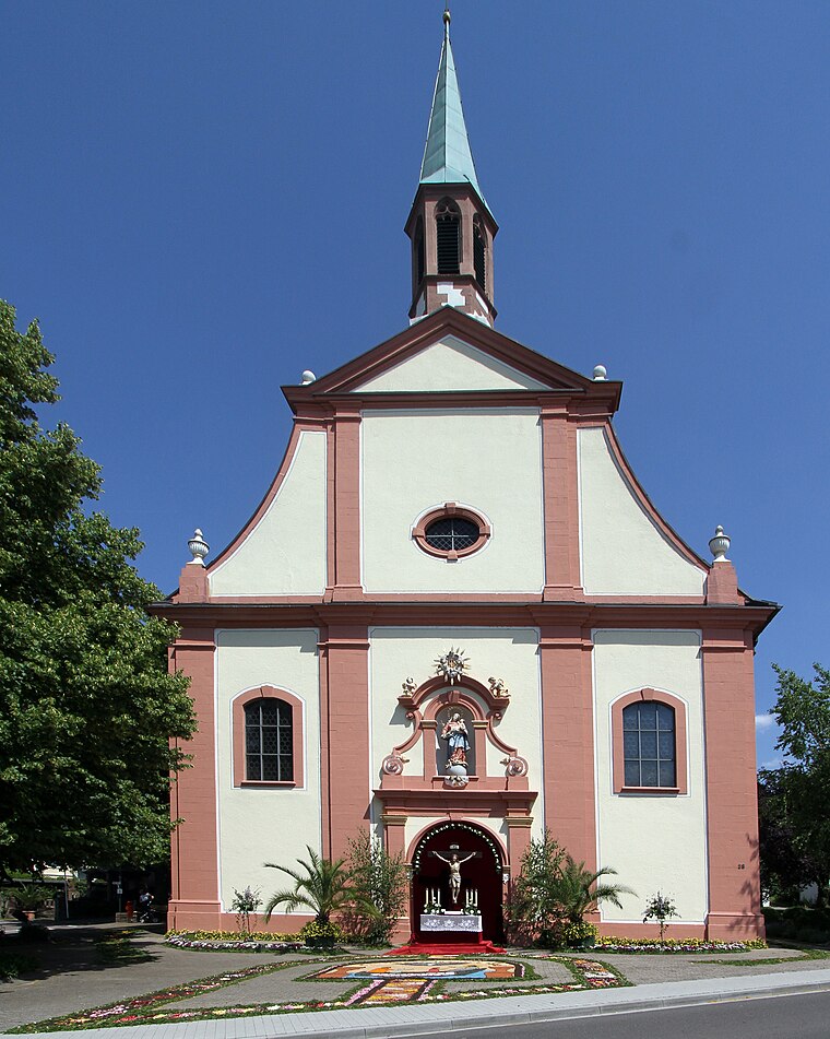
Photo: Gerd Eichmann, CC BY-SA 4.0.
Maria Linden is a church, which is situated 1½ km north of Stein: Unterer Mühlbach.
St. Leonhard
Church

Photo: Gerd Eichmann, CC BY-SA 4.0.
St. Leonhard is a church, which is situated 2 km southeast of Stein: Unterer Mühlbach.
Places in the Area
Nearby places include Lauf and Sasbach.
Lauf
Village

Photo: Gerd Eichmann, CC BY-SA 4.0.
Lauf is a municipality in the district of Ortenau in Western Baden-Württemberg, Germany. Lauf is a locality positioned at the western periphery of the Black Forest, also known as Schwarzwald, within the valley of Laufbachtal.
Sasbach
Village

Photo: Metallissimus, CC BY-SA 3.0.
Sasbach is a municipality in the district of Ortenau in Western Baden-Württemberg, Germany. Sasbach is situated 3 km southwest of Stein: Unterer Mühlbach.
Bühl
Town

Photo: Frank C. Müller, CC BY-SA 3.0.
Baden-Baden is a spa town built on thermal springs at the edge of the Black Forest in Baden Württemberg, south west Germany. It is one of 11 "Great Spa Towns of Europe", a transcontinental UNESCO world heritage site. Bühl is situated 4 km north of Stein: Unterer Mühlbach.
Stein: Unterer Mühlbach
- Type: Sign
- Categories: information and tourism
- Location: Ottersweier, Rastatt, Karlsruhe Region, Baden-Württemberg, Germany, Central Europe, Europe
- View on OpenStreetMap
Latitude
48.66024° or 48° 39′ 37″ northLongitude
8.11398° or 8° 6′ 50″ eastOpen location code
8FWCM467+3HOpenStreetMap ID
node 1779499100OpenStreetMap feature
tourism=information
This page is based on OpenStreetMap, Wikidata, and Wikimedia Commons.
We’d love your help improving our open data sources. Thank you for contributing.
Satellite Map
Discover Stein: Unterer Mühlbach from above in high-definition satellite imagery.
Notable Places Nearby
Highlights include Ehemaliger Friedhof Ottersweier and Rathaus Ottersweier.
Nearby Places
Explore places such as Untere Mühle and Hofladen Querfeldein.
Baden-Württemberg: Must-Visit Destinations
Delve into Stuttgart, Heidelberg, Karlsruhe, and Mannheim.
Curious Places to Discover
Uncover intriguing places from every corner of the globe.
About Mapcarta. Data © OpenStreetMap contributors and available under the Open Database License". Text is available under the CC BY-SA 4.0 license, except for photos, directions, and the map. Photo: Traveler100, CC BY-SA 3.0.