Orrido dello Slizza
Orrido dello Slizza is in Tarvisio, Friuli, Friuli-Venezia Giulia. Orrido dello Slizza is situated nearby to the playground Campetto DLF, as well as near the church Chiesa di San Michele.| Tap on a place to explore it |
Places of Interest Nearby
Highlights include Tarvisio Boscoverde railway station and San Nicolò Vescovo.
Tarvisio Boscoverde railway station
Railway station

Photo: Wikimedia, CC BY-SA 3.0.
Tarvisio Boscoverde is a railway station serving the town of Tarvisio, in the region of Friuli-Venezia Giulia, in Northern Italy. The station is managed by Rete Ferroviaria Italiana. Train services are operated by Trenitalia and ÖBB. Tarvisio Boscoverde railway station is situated 370 metres southeast of Orrido dello Slizza.
San Nicolò Vescovo
Church

Photo: Joadl, CC BY-SA 3.0.
San Nicolò Vescovo is a church, which is situated 1¼ km northeast of Orrido dello Slizza.
Tarvisio Città railway halt
Historic building
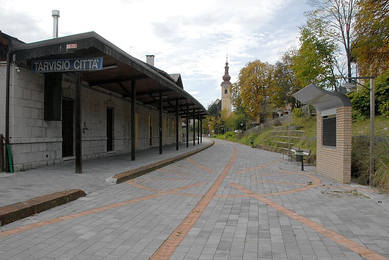
Photo: Johann Jaritz, CC BY-SA 3.0.
Tarvisio Città railway halt is a historic building, which is situated 1½ km west of Orrido dello Slizza.
Places in the Area
Nearby places include Coccau and Fusine in Valromana.

Fusine in Valromana
Village
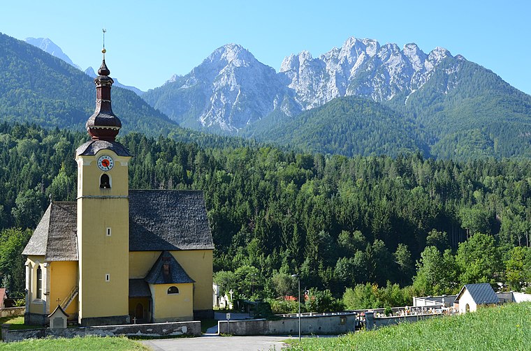
Photo: Johann Jaritz, CC BY-SA 3.0.
Fusine in Valromana is a frazione of the comune of Tarvisio in the Province of Udine, in the autonomous Friuli-Venezia Giulia region of northeastern Italy. Fusine in Valromana is situated 4 km east of Orrido dello Slizza.
Camporosso
Village

Photo: Johann Jaritz, CC BY-SA 3.0.
Camporosso is a village, which is situated 5 km west of Orrido dello Slizza.
Orrido dello Slizza
- Type: Tourist attraction
- Wheelchair access: no
- Category: tourism
- Location: Tarvisio, Friuli, Friuli-Venezia Giulia, Northeast Italy, Italy, Europe
- View on OpenStreetMap
Latitude
46.50843° or 46° 30′ 30″ northLongitude
13.60344° or 13° 36′ 12″ eastOpen location code
8FRMGJ53+99OpenStreetMap ID
node 1796251696OpenStreetMap feature
tourism=attractionOpenStreetMap attribute
wheelchair=no
This page is based on OpenStreetMap, Wikidata, and Wikimedia Commons.
We’d love your help improving our open data sources. Thank you for contributing.
Satellite Map
Discover Orrido dello Slizza from above in high-definition satellite imagery.
In Other Languages
From German to Italian—“Orrido dello Slizza” goes by many names.
- German: “Gailitz-Schlucht”
- Italian: “Orrido dello Slizza”
Notable Places Nearby
Highlights include Orrido dello Slizza and Campetto DLF.
Nearby Places
Explore places such as Monumento al Granatiere Austriaco and Carl Graf Arco.
Friuli-Venezia Giulia: Must-Visit Destinations
Delve into Trieste, Udine, Aquileia, and Gorizia.
Curious Places to Discover
Uncover intriguing places from every corner of the globe.
About Mapcarta. Data © OpenStreetMap contributors and available under the Open Database License". Text is available under the CC BY-SA 4.0 license, except for photos, directions, and the map. Photo: Johann Jaritz, CC BY-SA 3.0 at.