The Swan With Two Necks
The Swan With Two Necks is a pub in Maer, Newcastle-under-Lyme District, England which is located on Nantwich Road. The Swan With Two Necks is situated nearby to the forest Clowes‘ Plantation, as well as near Clowes‘ Wood.| Tap on a place to explore it |
- Type: Pub
- Also known as: “Swan Inn”
- Address: Nantwich Road, ST5 5EH
Places of Interest Nearby
Highlights include Church of St Peter and Church of St John the Baptist.
Church of St Peter
Church
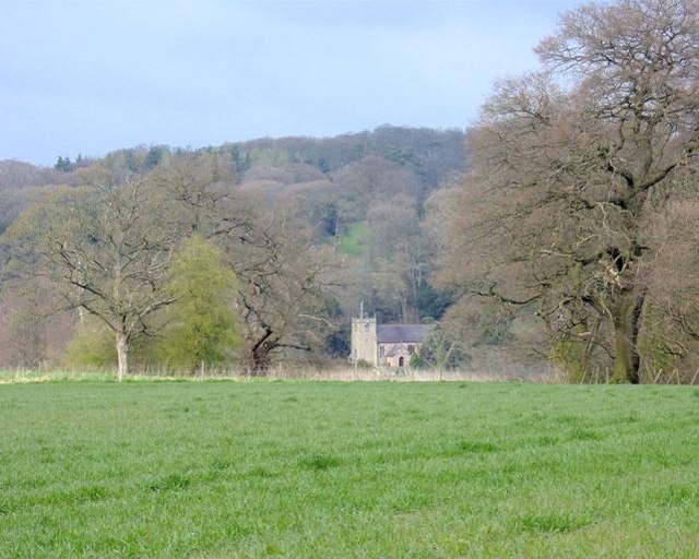
Photo: Simon Huguet, CC BY-SA 2.0.
Church of St Peter is situated 1¼ miles east of The Swan With Two Necks.
Church of St John the Baptist
Church

Photo: ChurchCrawler, CC BY-SA 2.0.
Church of St John the Baptist is situated 1½ miles southwest of The Swan With Two Necks.
Places in the Area
Nearby places include Baldwin’s Gate and Ashley.
Baldwin’s Gate
Village

Photo: charles c, CC BY-SA 2.0.
Baldwin's Gate is a village in the Borough of Newcastle-under-Lyme in Staffordshire. The population details for the 2011 census can be found under Whitmore. Baldwin’s Gate is situated 1½ miles northeast of The Swan With Two Necks.
Ashley
Village
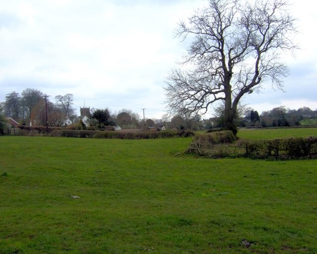
Photo: Simon Huguet, CC BY-SA 2.0.
Ashley is a village and former civil parish, now in the parish of Loggerheads, in the Newcastle-under-Lyme district, in the county of Staffordshire, England. Ashley is situated 1½ miles southwest of The Swan With Two Necks.
Loggerheads
Village

Photo: John Lord, CC BY-SA 2.0.
Loggerheads is a village and civil parish in north-west Staffordshire, England, on the A53 between Market Drayton and Newcastle-under-Lyme. The village is close to the border with Shropshire and Cheshire. Loggerheads is situated 2½ miles southwest of The Swan With Two Necks.
The Swan With Two Necks
Latitude
52.94582° or 52° 56′ 45″ northLongitude
-2.33897° or 2° 20′ 20″ westOpen location code
9C4VWMW6+8COpenStreetMap ID
node 1800236471OpenStreetMap feature
amenity=pub
This page is based on OpenStreetMap, Wikidata, and Wikimedia Commons.
We’d love your help improving our open data sources. Thank you for contributing.
Satellite Map
Discover The Swan With Two Necks from above in high-definition satellite imagery.
Places with the Same Name
Discover other places named “The Swan With Two Necks”.
Notable Places Nearby
Highlights include Clowes‘ Plantation and Clowes‘ Wood.
Nearby Places
Explore places such as Newcastle Road and Whitmore Road.
Staffordshire: Must-Visit Destinations
Delve into Stoke-on-Trent, Lichfield, Stafford, and Tamworth.
Curious Pubs to Discover
Uncover intriguing pubs from every corner of the globe.
About Mapcarta. Data © OpenStreetMap contributors and available under the Open Database License". Text is available under the CC BY-SA 4.0 license, except for photos, directions, and the map. Photo: Wikimedia, CC0.