DRK-Haus ‘Am Volksgarten’
DRK-Haus ‘Am Volksgarten’ is an office in Mönchengladbach, Düsseldorf, North Rhine-Westphalia which is located on Carl-Diem-Straße. DRK-Haus ‘Am Volksgarten’ is situated nearby to the pitch PSV 1926 Mönchengladbach e.V., as well as near the sports venue Sportanlage Radrennbahn.| Tap on a place to explore it |
Places of Interest Nearby
Highlights include Mönchengladbach Hauptbahnhof and Schloss Rheydt.
Mönchengladbach Hauptbahnhof
Railway station
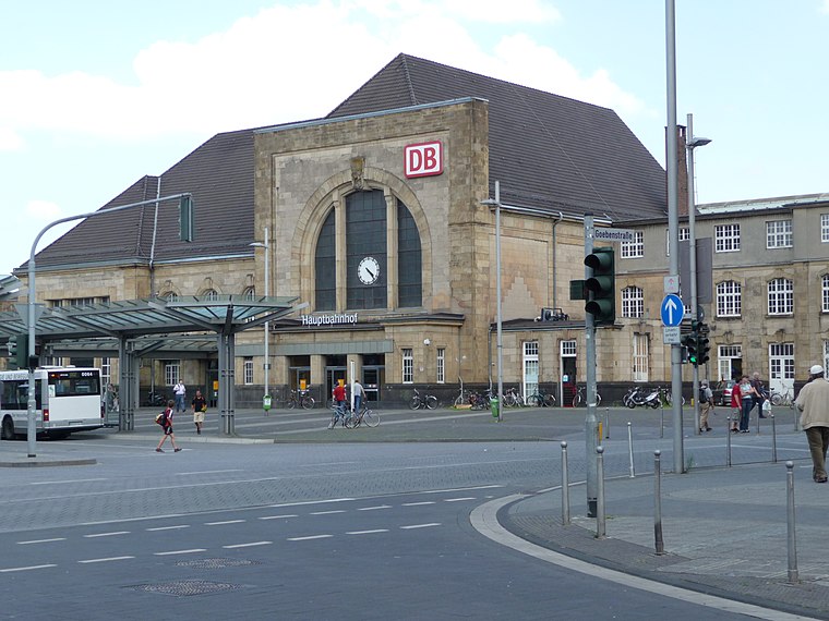
Photo: Thalan, CC BY-SA 3.0.
Mönchengladbach Hauptbahnhof is a railway station in the city of Mönchengladbach in western Germany. Mönchengladbach Hauptbahnhof is situated 1½ km northwest of DRK-Haus ‘Am Volksgarten’.
Schloss Rheydt

Photo: Wikimedia, CC BY-SA 2.0.
Schloss Rheydt is a Renaissance palace in Rheydt, Mönchengladbach, North Rhine-Westphalia, Germany. Over the years the building has been the family seat of various noble families, including the Bylandt-Rheydt dynasty that ruled over Rheydt for over 300 years and gave the palace its present look. Schloss Rheydt is situated 1½ km southeast of DRK-Haus ‘Am Volksgarten’.
Herz-Jesu-Kirche Pesch
Church

Photo: Chris06, CC BY-SA 4.0.
Herz-Jesu-Kirche Pesch is a church, which is situated 1 km west of DRK-Haus ‘Am Volksgarten’.
Places in the Area
Nearby places include Lürrip and Am Wasserturm.

Am Wasserturm
Neighborhood

Photo: Arcturus, CC BY-SA 3.0.
Am Wasserturm is a neighborhood, which is situated 3 km northwest of DRK-Haus ‘Am Volksgarten’.
Korschenbroich
Town

Photo: Kateer, CC BY-SA 3.0.
Korschenbroich is a town in the Rhein-Kreis Neuss, in North Rhine-Westphalia, Germany. It is situated on the river Niers, approx. 13 km west of Neuss and 5 km east of Mönchengladbach. Korschenbroich is situated 3½ km east of DRK-Haus ‘Am Volksgarten’.
DRK-Haus ‘Am Volksgarten’
- Type: Voluntary association
- Address: Carl-Diem-Straße
- Category: office
- Location: Mönchengladbach, Düsseldorf, Lower Rhine, North Rhine-Westphalia, Germany, Central Europe, Europe
- View on OpenStreetMap
Latitude
51.19152° or 51° 11′ 30″ northLongitude
6.46372° or 6° 27′ 49″ eastBrand
German Red CrossOpen location code
9F385FR7+JFOpenStreetMap ID
node 1815856541OpenStreetMap feature
office=association
This page is based on OpenStreetMap, Wikidata, and Wikimedia Commons.
We’d love your help improving our open data sources. Thank you for contributing.
Satellite Map
Discover DRK-Haus ‘Am Volksgarten’ from above in high-definition satellite imagery.
Notable Places Nearby
Highlights include PSV 1926 Mönchengladbach e.V. and Sportanlage Radrennbahn.
Nearby Places
Explore places such as DRK-Haus ‘Am Volksgarten’ and Restaurant Salinas.
Lower Rhine: Must-Visit Destinations
Delve into Düsseldorf, Krefeld, Neuss, and Kleve.
Curious Places to Discover
Uncover intriguing places from every corner of the globe.
About Mapcarta. Data © OpenStreetMap contributors and available under the Open Database License". Text is available under the CC BY-SA 4.0 license, except for photos, directions, and the map. Photo: CaS2000, CC BY-SA 3.0 de.