Pollmanns-Gas
Pollmanns-Gas is a gas station in Gröningen, Börde Rural District, Saxony-Anhalt. Pollmanns-Gas is situated nearby to the peak Kepper-Berg, as well as near the nature reserve Seeburg.| Tap on a place to explore it |
Places of Interest Nearby
Highlights include Dorfkirche Dalldorf and St. Liborius.
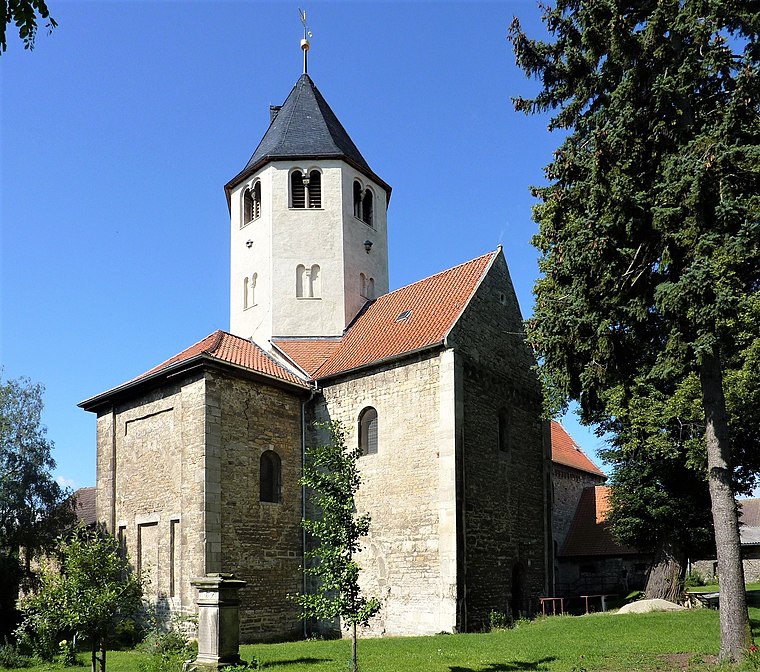
Dorfkirche Dalldorf
Church

Photo: Olaf2, CC BY-SA 3.0.
Dorfkirche Dalldorf is a church, which is situated 2 km southeast of Pollmanns-Gas.
St. Liborius
Church

Photo: Kirchenfan, CC0.
St. Liborius is a church, which is situated 2 km west of Pollmanns-Gas.
St. Martini (Gröningen)
Church

Photo: Olaf2, CC BY-SA 3.0.
St. Martini (Gröningen) is a church, which is situated 2½ km west of Pollmanns-Gas.
Places in the Area
Nearby places include Gröningen and Gröningen Priory.
Gröningen
Town
Photo: Kirchenfan, CC0.
Gröningen is a town in the Börde district in Saxony-Anhalt, Germany. It lies approx. 40 km south-west of Magdeburg, and 10 km east of Halberstadt. It has 3.621 inhabitants. Gröningen is part of the Verbandsgemeinde Westliche Börde. Gröningen is situated 2½ km west of Pollmanns-Gas.
Gröningen Priory
Village
 Gröningen Priory was a Benedictine monastery, located west of Gröningen in present-day Saxony-Anhalt, Germany. The abbey church is part of the Romanesque Road scenic route. Gröningen Priory is situated 4 km west of Pollmanns-Gas.
Heteborn
Village
Heteborn is a village and a former municipality in the district of Harz, in Saxony-Anhalt, Germany. Since 1 January 2010, it is part of the municipality Selke-Aue. Heteborn is situated 6 km southeast of Pollmanns-Gas.
Pollmanns-Gas
- Type: Gas station
- Category: transportation
- Location: Gröningen, Börde Rural District, Saxony-Anhalt, Germany, Central Europe, Europe
- View on OpenStreetMap
Latitude
51.94039° or 51° 56′ 25″ northLongitude
11.25418° or 11° 15′ 15″ eastOpen location code
9F3HW7R3+5MOpenStreetMap ID
node 1884183070OpenStreetMap feature
amenity=fuel
This page is based on OpenStreetMap, Wikidata, and Wikimedia Commons.
We’d love your help improving our open data sources. Thank you for contributing.
Satellite Map
Discover Pollmanns-Gas from above in high-definition satellite imagery.
Notable Places Nearby
Highlights include Kepper-Berg and Thietal.
Nearby Places
Explore places such as Autoverwertung Rössler and Heynburger Hof.
Saxony-Anhalt: Must-Visit Destinations
Delve into Magdeburg, Halle, Wittenberg, and Quedlinburg.
Curious Gas Stations to Discover
Uncover intriguing gas stations from every corner of the globe.
About Mapcarta. Data © OpenStreetMap contributors and available under the Open Database License". Text is available under the CC BY-SA 4.0 license, except for photos, directions, and the map. Photo: GMM, Public domain.