Treix
Treix is a hamlet in Ars, Arrondissement of Guéret, Nouvelle-Aquitaine. Treix is situated nearby to the hamlet Villeloube, as well as near Arfeuille.| Tap on a place to explore it |
Places of Interest
Highlights include Église Saint-Barthélemy d’Ars and Pierre de la Fade.
Église Saint-Barthélemy d’Ars
Church
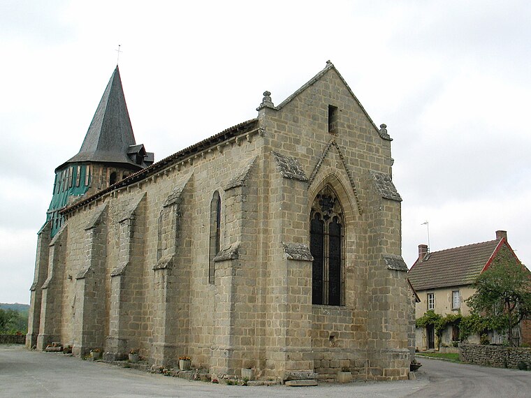
Photo: Fourgeaudg, CC BY-SA 3.0.
Église Saint-Barthélemy d’Ars is a church.
Pierre de la Fade
Archaeological site

Photo: Aubussonais, CC BY-SA 3.0.
Pierre de la Fade is an archaeological site, which is situated 3½ km south of Treix.
Église Saint-Thomas-de-Cantorbéry de la Borne
Church

Photo: Père Igor, CC BY-SA 4.0.
Église Saint-Thomas-de-Cantorbéry de la Borne is a church, which is situated 3½ km south of Treix.
Places in the Area
Nearby places include Masgot and Aubusson.
Masgot
Hamlet

Photo: LucasD, CC BY-SA 4.0.
Masgot is a hamlet, which is situated 7 km northwest of Treix.
Aubusson
Town
 Aubusson is a commune in the Creuse department region in central France. Aubusson is situated 7 km southeast of Treix.
Treix
- Type: Hamlet
- Category: locality
- Location: Ars, Arrondissement of Guéret, Creuse, Nouvelle-Aquitaine, France, Europe
- View on OpenStreetMap
Latitude
45.99343° or 45° 59′ 36″ northLongitude
2.09491° or 2° 5′ 42″ eastOpen location code
8FQ4X3VV+9XOpenStreetMap ID
node 1951047148OpenStreetMap feature
place=hamlet
This page is based on OpenStreetMap, Wikidata, and Wikimedia Commons.
We’d love your help improving our open data sources. Thank you for contributing.
Satellite Map
Discover Treix from above in high-definition satellite imagery.
Places with the Same Name
Discover other places named “Treix”.
Localities in the Area
Explore places such as Villeloube and Arfeuille.
Notable Places Nearby
Highlights include ARS and Mairie de la Commune Associée de la Rochette.
Nouvelle-Aquitaine: Must-Visit Destinations
Delve into Bordeaux, Deux-Sèvres, Charente, and Poitiers.
Curious Hamlets to Discover
Uncover intriguing hamlets from every corner of the globe.
About Mapcarta. Data © OpenStreetMap contributors and available under the Open Database License". Text is available under the CC BY-SA 4.0 license, except for photos, directions, and the map. Photo: Noeljupiter, CC BY-SA 3.0.