Morro do Incanhema
Morro do Incanhema is a peak in Guarujá, Santos and South Coast, São Paulo and has an elevation of 173 metres. Morro do Incanhema is situated nearby to the neighborhood Vila Santa Cruz dos Navegantes, as well as near the suburb Vila Ligia.| Tap on a place to explore it |
Places of Interest
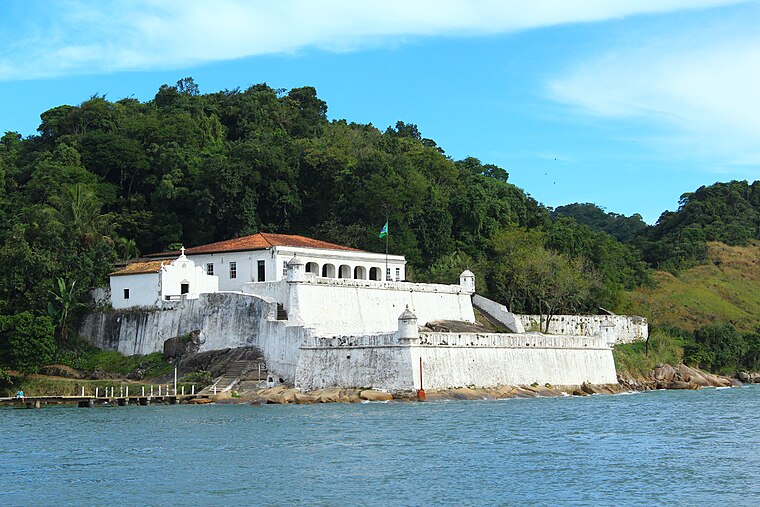
Highlights include Fortress of Santo Amaro da Barra Grande and Praia do Guaiuba.


Places in the Area
Nearby places include Ponta da Praia.

Morro do Incanhema
- Type: Peak with an elevation of 173 metres
- Category: landform
- Location: Guarujá, Santos and South Coast, São Paulo, Southeast, Brazil, South America
- View on OpenStreetMap
Latitude
-24.0125° or 24° 0′ 45″ southLongitude
-46.2953° or 46° 17′ 43″ westElevation
173 metres (568 feet)Open location code
587MXPP3+XVOpenStreetMap ID
node 2013137866OpenStreetMap feature
natural=peak
This page is based on OpenStreetMap, Wikidata, and Wikimedia Commons.
We’d love your help improving our open data sources. Thank you for contributing.
Satellite Map
Discover Morro do Incanhema from above in high-definition satellite imagery.
Localities in the Area
Explore places such as Vila Santa Cruz dos Navegantes and Vila Ligia.
Notable Places Nearby
Highlights include Praça Lions Club and Marina Dolfin.
Santos and South Coast: Must-Visit Destinations
Delve into Santos, São Vicente, Cubatão, and Praia Grande.
Curious Peaks to Discover
Uncover intriguing peaks from every corner of the globe.
About Mapcarta. Data © OpenStreetMap contributors and available under the Open Database License". Text is available under the CC BY-SA 4.0 license, except for photos, directions, and the map. Photo: Wikimedia, CC BY-SA 3.0.