Grocery Station
Grocery Station is a convenience store in Tower Hamlets, Greater London, England which is located on Ratcliffe Lane. Grocery Station is situated nearby to the sauna Sailors, as well as near the railway station Limehouse station.| Tap on a place to explore it |
- Opening hours:
Monday—Saturday: 8:00 AM—9:00 PM
Sunday: 8:00 AM—7:00 PM - Type: Convenience store
- Address: 242 Ratcliffe Lane, London, E14 7JE
Places of Interest Nearby
Highlights include Limehouse station and Half Moon Theatre.
Limehouse station
Railway station
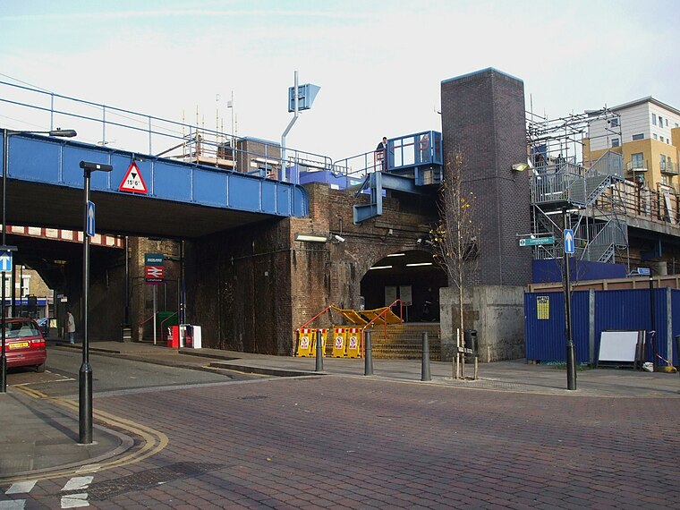
Photo: Sunil060902, CC BY-SA 3.0.
Limehouse is a National Rail and connected Docklands Light Railway station in Limehouse, London, England. It is served by regional services operated by c2c to and from Fenchurch Street and by light metro services provided by the DLR to and from Tower Gateway or Bank.
Half Moon Theatre
Theater building

Photo: Ewan Munro, CC BY-SA 2.0.
The Half Moon Theatre Company was formed in 1972 in a rented synagogue in Alie Street, Whitechapel, in the London Borough of Tower Hamlets. Half Moon Passage was the name of a nearby alley. Half Moon Theatre is situated 400 feet northwest of Grocery Station.
Royal Foundation of St Katharine
Hotel

Photo: Wikimedia, Public domain.
The Royal Foundation of St Katharine is a religious charity based in the East End of London. The Foundation traces its origins back to the medieval church and monastic hospital St Katharine's by the Tower, established in 1147, next to the Tower of London.
Places in the Area
Nearby places include Ratcliff and Limehouse.
Ratcliff
Quarter
Ratcliff or Ratcliffe is a locality in the London Borough of Tower Hamlets. It lies on the north bank of the River Thames between Limehouse, and Shadwell. The place name is no longer commonly used.
Limehouse
Suburb
Photo: Wikimedia, CC BY-SA 3.0.
Limehouse is a district in the London Borough of Tower Hamlets in East London. It is 3.9 miles east of Charing Cross, on the northern bank of the River Thames.
Stepney
Suburb

Photo: Tarquin Binary, CC BY-SA 2.5.
Stepney is an area in the London Borough of Tower Hamlets in the East End of London. Stepney is no longer officially defined, and is usually used to refer to a relatively small area.
Grocery Station
- Categories: shop and food
- Location: Tower Hamlets, Greater London, England, United Kingdom, Britain and Ireland, Europe
- View on OpenStreetMap
Latitude
51.51232° or 51° 30′ 44″ northLongitude
-0.0403° or 0° 2′ 25″ westOpen location code
9C3XGX65+WVOpenStreetMap ID
node 2023954806OpenStreetMap feature
shop=convenience
This page is based on OpenStreetMap, Wikidata, and Wikimedia Commons.
We’d love your help improving our open data sources. Thank you for contributing.
Satellite Map
Discover Grocery Station from above in high-definition satellite imagery.
Notable Places Nearby
Highlights include Sailors and Community and Wellbeing Hub.
Nearby Places
Explore places such as Limehouse News and The Clement Attlee.
England: Must-Visit Destinations
Delve into London, Manchester, Sheffield, and Leeds.
Curious Convenience Stores to Discover
Uncover intriguing convenience stores from every corner of the globe.
About Mapcarta. Data © OpenStreetMap contributors and available under the Open Database License". Text is available under the CC BY-SA 4.0 license, except for photos, directions, and the map. Photo: sidibousaid, CC BY 2.0.