Daniels-Brunnen
Daniels-Brunnen is a spring in Annweiler am Trifels, Südliche Weinstraße, Rhineland-Palatinate. Daniels-Brunnen is situated nearby to the peak Almersberg, as well as near Großer Fischberg.| Tap on a place to explore it |
Places of Interest Nearby
Highlights include Almersberg and Wilgartaburg.

Wilgartaburg
Castle
 The Wilgartaburg, also called the Wiligartaburg, Wilgartsburg or Wiligartisburg, is the heritage site of a ruined rock castle located at a height of 245 m above sea level near the German village of Wilgartswiesen in the state of Rhineland-Palatinate. Wilgartaburg is situated 3½ km southwest of Daniels-Brunnen.
Cistercian Monastery Church of St. Bernhard Eußerthal
Church

Photo: Gerd Eichmann, CC BY-SA 4.0.
Eusserthal Abbey was a Cistercian abbey in Eusserthal near Annweiler am Trifels in the Rhineland-Palatinate, Germany. All that now remains of it is the front portion of the abbey church, which is now used as a parish church. Cistercian Monastery Church of St. Bernhard Eußerthal is situated 3 km east of Daniels-Brunnen.
Places in the Area
Nearby places include Eußerthal and Rinnthal.
Eußerthal
Village

Photo: Gerd Eichmann, CC BY-SA 4.0.
Eußerthal is a municipality in the Südliche Weinstraße district of Rhineland-Palatinate, Germany. Eußerthal is situated 3 km east of Daniels-Brunnen.
Rinnthal
Village

Photo: Gerd Eichmann, CC BY-SA 4.0.
Rinnthal is a municipality in Südliche Weinstraße district, in Rhineland-Palatinate, western Germany. During the Revolution of 1848, the town was the setting for a battle between Prussian army troops and Palatinate revolutionary forces who were resisting the invasion. Rinnthal is situated 3½ km south of Daniels-Brunnen.
Vogelstockerhof
Hamlet
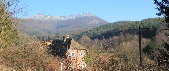
Photo: Vogelstockerhof, CC BY-SA 4.0.
Vogelstockerhof is a hamlet, which is situated 5 km east of Daniels-Brunnen.
Daniels-Brunnen
- Type: Spring
- Category: body of water
- Location: Annweiler am Trifels, Südliche Weinstraße, Rhineland-Palatinate, Germany, Central Europe, Europe
- View on OpenStreetMap
Latitude
49.2474° or 49° 14′ 51″ northLongitude
7.93008° or 7° 55′ 48″ eastOpen location code
8FX96WWJ+X2OpenStreetMap ID
node 2025045861OpenStreetMap feature
natural=spring
This page is based on OpenStreetMap, Wikidata, and Wikimedia Commons.
We’d love your help improving our open data sources. Thank you for contributing.
Satellite Map
Discover Daniels-Brunnen from above in high-definition satellite imagery.
Notable Places Nearby
Highlights include Almersberg and Langentaltürmchen.
Nearby Places
Explore places such as Dörrentalhütte and Willkommen im Stadtwald von Annweiler.
Rhineland-Palatinate: Must-Visit Destinations
Delve into Mainz, Trier, Koblenz, and Worms.
Curious Springs to Discover
Uncover intriguing springs from every corner of the globe.
About Mapcarta. Data © OpenStreetMap contributors and available under the Open Database License". Text is available under the CC BY-SA 4.0 license, except for photos, directions, and the map. Photo: Traveler100, CC BY-SA 3.0.