Dolores Deluxe
Dolores Deluxe is a convenience store in San Francisco, Bay Area, California. Dolores Deluxe is situated nearby to the reservoir Cistern at Dolores & 22nd, as well as near the tram stop Right Of Way/21st Street station.| Tap on a place to explore it |
Places of Interest Nearby
Highlights include Right Of Way/21st Street station and Church and 24th Street station.
Right Of Way/21st Street station
Tram stop

Photo: Pi.1415926535, CC BY-SA 3.0.
Right Of Way/21st Street station is a light rail stop on the Muni Metro J Church line, located in the Dolores Heights neighborhood of San Francisco, California. Right Of Way/21st Street station is situated 590 feet northwest of Dolores Deluxe.
Church and 24th Street station
Railway station

Photo: Pi.1415926535, CC BY-SA 3.0.
Church and 24th Street is a light rail stop on the Muni Metro J Church line, located in the Noe Valley neighborhood of San Francisco, California. The stop opened with the line on August 11, 1917. Church and 24th Street station is situated 1,300 feet south of Dolores Deluxe.
Mission Dolores Park
Park

Photo: Artico2, CC BY-SA 3.0.
Mission Dolores Park, often abbreviated to Dolores Park, is a city park in San Francisco, California. It is located two blocks south of Mission Dolores at the western edge of the Mission District.
Places in the Area
Nearby places include Noe Valley and Mission.
Noe Valley
Quarter
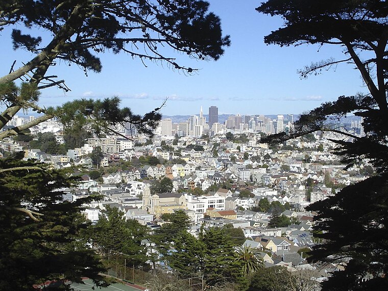
Photo: Yaman32, CC BY-SA 3.0.
Noe Valley is a neighborhood in the central part of San Francisco, California. It is named for Don José de Jesús Noé, noted 19th-century Californio statesman and ranchero, who owned much of the area and served as mayor.
Mission
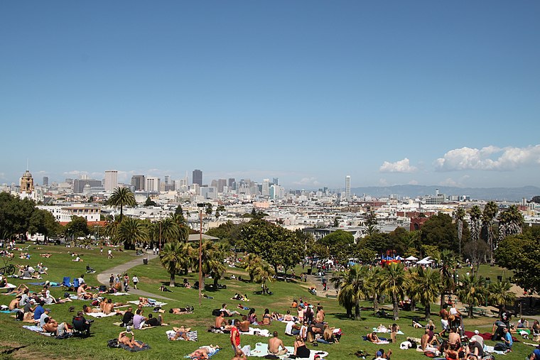
Photo: Tim Bartel, CC BY-SA 2.0.
The Mission District is a district of San Francisco noted for its ethnic diversity, in particular the neighborhood's large Hispanic community. Though the district has gentrified and is among the more expensive areas for real estate in the city, many urban…
Castro-Noe Valley

Photo: brian kusler, CC BY 2.0.
The colorful Castro is the famous gay center of San Francisco, a vibrant and historic neighborhood full of businesses geared towards the city's LGBT community.
Dolores Deluxe
- Type: Convenience store
- Categories: shop and food
- Location: San Francisco, Bay Area, California, United States, North America
- View on OpenStreetMap
Latitude
37.75511° or 37° 45′ 18″ northLongitude
-122.42575° or 122° 25′ 33″ westOpen location code
849VQH4F+2MOpenStreetMap ID
node 2069103495OpenStreetMap feature
shop=convenience
This page is based on OpenStreetMap, Wikidata, and Wikimedia Commons.
We’d love your help improving our open data sources. Thank you for contributing.
Satellite Map
Discover Dolores Deluxe from above in high-definition satellite imagery.
Notable Places Nearby
Highlights include Cistern at Dolores & 22nd and 23rd Street Studio.
Nearby Places
Explore places such as Bay Wheels and Downing & Company Real Estate Services.
San Francisco: Must-Visit Destinations
Delve into Golden Gate, Chinatown-North Beach, Civic Center-Tenderloin, and Fisherman’s Wharf.
Curious Convenience Stores to Discover
Uncover intriguing convenience stores from every corner of the globe.
About Mapcarta. Data © OpenStreetMap contributors and available under the Open Database License". Text is available under the CC BY-SA 4.0 license, except for photos, directions, and the map. Photo: Wikimedia, CC BY-SA 3.0.