CECYL
CECYL is a public building in Burgos, Castile and León. CECYL is situated nearby to Plaza de las Bernardas, as well as near the health club Salomon Training.| Tap on a place to explore it |
Places of Interest Nearby
Highlights include San Lesmes Abad and Subdelegacion del Gobierno.
San Lesmes Abad
Church

Photo: Eltitomac, Public domain.
Iglesia de San Lesmes Abad is a Roman Catholic church in Burgos, Spain. It is located in the Plaza de San Juan, in front of the Public Library, adjacent to the Camino de Santiago. San Lesmes Abad is situated 170 metres west of CECYL.
Subdelegacion del Gobierno
Government building
 Subdelegacion del Gobierno is a government building, which is situated 250 metres southwest of CECYL.
Museum of Human Evolution
Museum
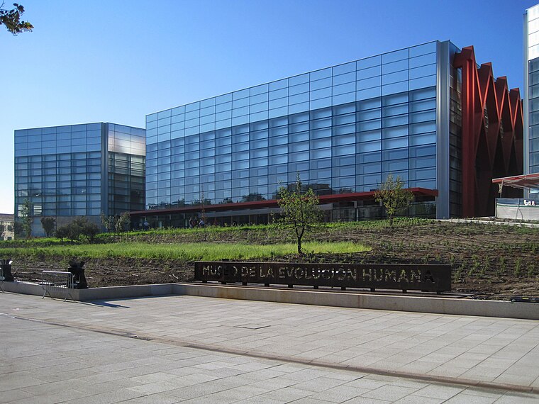
Photo: Eltitomac, Public domain.
The Museum of Human Evolution is situated on the south bank of the river Arlanzón, in the Spanish city of Burgos. It is located roughly 16 kilometers west of the Sierra de Atapuerca, the location of some of the most important human fossil finds in the world. Museum of Human Evolution is situated 560 metres southwest of CECYL.
Places in the Area
Nearby places include San Pedro y San Felices and Gamonal.
San Pedro y San Felices
Suburb

Photo: Eltitomac, Public domain.
San Pedro y San Felices is a suburb.

Hospital del Rey
Locality

Photo: Eltitomac, Public domain.
Hospital del Rey is a locality, which is situated 3 km west of CECYL.
CECYL
- Type: Public building
- Categories: building and government building
- Location: Burgos, Burgos, Castile and León, Central Spain, Spain, Iberia, Europe
- View on OpenStreetMap
Latitude
42.34362° or 42° 20′ 37″ northLongitude
-3.69417° or 3° 41′ 39″ westOpen location code
8CJR88V4+C8OpenStreetMap ID
node 2076142777OpenStreetMap feature
building=public
This page is based on OpenStreetMap, Wikidata, and Wikimedia Commons.
We’d love your help improving our open data sources. Thank you for contributing.
Satellite Map
Discover CECYL from above in high-definition satellite imagery.
Notable Places Nearby
Highlights include Plaza de las Bernardas and Salomon Training.
Nearby Places
Explore places such as SC and FIT Spain.
Castile and León: Must-Visit Destinations
Delve into Valladolid, Salamanca, León, and Segovia.
Curious Public Buildings to Discover
Uncover intriguing public buildings from every corner of the globe.
About Mapcarta. Data © OpenStreetMap contributors and available under the Open Database License". Text is available under the CC BY-SA 4.0 license, except for photos, directions, and the map. Photo: Choniron, CC BY-SA 3.0 es.