Hey Farm
Hey Farm is a building in Kirklees, England. Hey Farm is situated nearby to the neighborhood Lowerhouses, as well as near the suburb Longley.| Tap on a place to explore it |
Places of Interest Nearby
Highlights include Castle Hill and Victoria Tower.
Castle Hill
Scenic viewpoint
Castle Hill is a scheduled ancient monument in Almondbury overlooking Huddersfield in the Metropolitan Borough of Kirklees, West Yorkshire, England. The hilltop has been settled for at least 4,000 years. Castle Hill is situated 1 mile southwest of Hey Farm.
Victoria Tower

Photo: Stevekraken, CC BY-SA 4.0.
Victoria Tower is situated 1 mile southwest of Hey Farm.
Lawrence Batley Theatre
Theater building
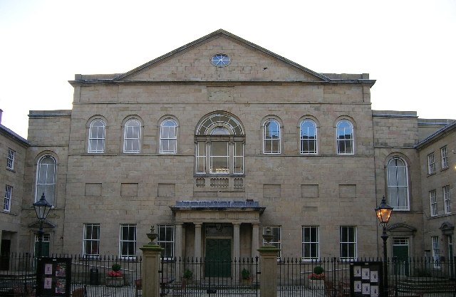
Photo: Ian M, CC BY-SA 2.0.
Lawrence Batley Theatre is a theatre in Huddersfield, West Yorkshire, England which offers drama, music, dance and comedy. The theatre is named after Lawrence Batley, a local entrepreneur and philanthropist, who founded a nationwide cash and carry chain. Lawrence Batley Theatre is situated 1 mile northwest of Hey Farm.
Places in the Area
Nearby places include Lowerhouses and Longley.
Lowerhouses
Neighborhood

Photo: Wikimedia, CC BY-SA 3.0.
Lowerhouses is a residential district in the town of Huddersfield, Kirklees, West Yorkshire, England. Lowerhouses is a residential district situated in a wooded hillside, adjacent to Hall Bower, between Newsome and Almondbury, approximately 1 mile of Huddersfield town centre.
Longley
Suburb
Longley is a small district in Huddersfield, West Yorkshire, England between Newsome and Lowerhouses. The area is mainly made up of woodland and a 9-hole golf course. Longley Old Hall, a listed building, is also in the area.
Almondbury
Village

Photo: Humphrey Bolton, CC BY-SA 2.0.
Almondbury is a village 2 miles south-east of Huddersfield town centre in the Kirklees district, of West Yorkshire, England. The population of Almondbury in 2001 was 7,368 increasing to 18,346 at the 2011 census.
Hey Farm
- Type: Building
- Location: Kirklees, England, United Kingdom, Britain and Ireland, Europe
- View on OpenStreetMap
Latitude
53.63329° or 53° 37′ 60″ northLongitude
-1.76335° or 1° 45′ 48″ westOpen location code
9C5WJ6MP+8MOpenStreetMap ID
node 2098702406OpenStreetMap feature
building=yes
This page is based on OpenStreetMap, Wikidata, and Wikimedia Commons.
We’d love your help improving our open data sources. Thank you for contributing.
Satellite Map
Discover Hey Farm from above in high-definition satellite imagery.
Places with the Same Name
Discover other places named “Hey Farm”.
Notable Places Nearby
Highlights include Longley and Lowerhouses Community Church and Lowerhouses Community Crown Green Bowls Club.
Nearby Places
Explore places such as Hey Lane Allotments and Hey Green.
England: Must-Visit Destinations
Delve into London, Manchester, Sheffield, and Leeds.
Curious Buildings to Discover
Uncover intriguing buildings from every corner of the globe.
About Mapcarta. Data © OpenStreetMap contributors and available under the Open Database License". Text is available under the CC BY-SA 4.0 license, except for photos, directions, and the map. Photo: sidibousaid, CC BY 2.0.