Harvest Hills Market
Harvest Hills Market is a convenience store in San Francisco, Bay Area, California. Harvest Hills Market is situated nearby to Immaculate Conception Church, as well as near Saint Anthony of Padua Church.| Tap on a place to explore it |
Places of Interest Nearby
Highlights include Bernal Heights Summit and Garfield Square.
Bernal Heights Summit
Peak

Photo: Octoferret, CC BY-SA 2.5.
Bernal Heights Summit or Bernal Heights Hill is a hill in the San Francisco, California neighborhood of Bernal Heights. Upper elevations are part of Bernal Heights Park, which the San Francisco Recreation & Parks Department manages.
Garfield Square
Park

Photo: LuisVilla, CC BY-SA 3.0.
Garfield Square, also known as Garfield Park, is a 3.46-acre city park located in the Mission District of San Francisco, California. It is bounded by 25th Street to the north, 26th Street to the south, Treat Avenue to the west, and Harrison Street to the east and was first opened in 1884.

Places in the Area
Nearby places include Bernal Heights and Alemany Maze.
Bernal Heights
Photo: Octoferret, CC BY-SA 2.5.
Bernal Heights, just south of the Mission District of San Francisco, is a cute, eclectic neighborhood that was once very working class, but is becoming quickly gentrified.
Alemany Maze
Locality
The Alemany Maze is an interchange between the James Lick Freeway and the John F. Foran Freeway in the city of San Francisco. Alternative names for this highway feature are Alemany Interchange and The Spaghetti Bowl.
Mission
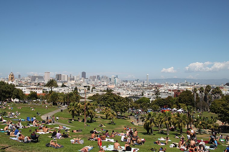
Photo: Tim Bartel, CC BY-SA 2.0.
The Mission District is a district of San Francisco noted for its ethnic diversity, in particular the neighborhood's large Hispanic community. Though the district has gentrified and is among the more expensive areas for real estate in the city, many urban…
Harvest Hills Market
- Type: Convenience store
- Wheelchair access: yes
- Categories: shop and food
- Location: San Francisco, Bay Area, California, United States, North America
- View on OpenStreetMap
Latitude
37.74674° or 37° 44′ 48″ northLongitude
-122.41372° or 122° 24′ 49″ westOpen location code
849VPHWP+MGOpenStreetMap ID
node 2130160676OpenStreetMap feature
shop=convenienceOpenStreetMap attribute
wheelchair=yes
This page is based on OpenStreetMap, Wikidata, and Wikimedia Commons.
We’d love your help improving our open data sources. Thank you for contributing.
Satellite Map
Discover Harvest Hills Market from above in high-definition satellite imagery.
Notable Places Nearby
Highlights include Immaculate Conception Church and Saint Anthony of Padua Church.
Nearby Places
Explore places such as Folsom Street & Bessie Street and Marlena.
San Francisco: Must-Visit Destinations
Delve into Golden Gate, Chinatown-North Beach, Civic Center-Tenderloin, and Fisherman’s Wharf.
Curious Convenience Stores to Discover
Uncover intriguing convenience stores from every corner of the globe.
About Mapcarta. Data © OpenStreetMap contributors and available under the Open Database License". Text is available under the CC BY-SA 4.0 license, except for photos, directions, and the map. Photo: Wikimedia, CC BY-SA 3.0.