Wald-/Ecke Knaudenheimer Straße
Wald-/Ecke Knaudenheimer Straße is a transport stop in Philippsburg, Karlsruhe, Baden-Württemberg. Wald-/Ecke Knaudenheimer Straße is situated nearby to the sports venue FC Huttenheim 1920, as well as near the pitch Molzau-Stadion.| Tap on a place to explore it |
Places of Interest Nearby
Highlights include St. Peter and Jewish Cemetery.
St. Peter
Church
 St. Peter is a church, which is situated 340 metres south of Wald-/Ecke Knaudenheimer Straße.
Jewish Cemetery
Cemetery

Photo: LigaDue, CC BY-SA 4.0.
Jewish Cemetery is situated 2 km north of Wald-/Ecke Knaudenheimer Straße.
Philippsburg station
Railway station

Photo: BlueBreezeWiki, CC BY-SA 3.0.
Philippsburg station is a railway station in the municipality of Philippsburg, located in the Karlsruhe district in Baden-Württemberg, Germany. Philippsburg station is situated 3½ km north of Wald-/Ecke Knaudenheimer Straße.
Places in the Area
Nearby places include Graben-Neudorf and Waghäusel.
Graben-Neudorf
Village
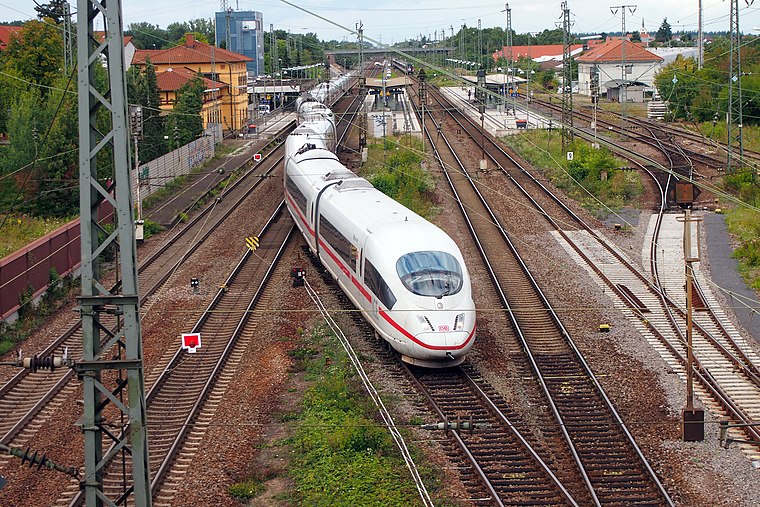
Photo: BlueBreezeWiki, CC BY-SA 3.0.
Graben-Neudorf is a municipality in Northern Karlsruhe district in Baden-Württemberg, Germany. It was created when the two communities of Graben and Neudorf were united on January 1, 1972. Graben-Neudorf is situated 4½ km southeast of Wald-/Ecke Knaudenheimer Straße.
Waghäusel
Town

Photo: Claus Ableiter, CC BY-SA 4.0.
Waghäusel is a town located in the Rhine valley in the south-western state of Baden-Württemberg, Germany. Waghäusel consists of 3 townships which are the core town, Kirrlach, and Wiesental. Waghäusel is situated 6 km northeast of Wald-/Ecke Knaudenheimer Straße.
Oberhausen
Village

Photo: Immanuel Giel, CC BY-SA 3.0.
Oberhausen is a village, which is situated 7 km north of Wald-/Ecke Knaudenheimer Straße.
Wald-/Ecke Knaudenheimer Straße
- Type: Transport stop
- Category: transportation
- Location: Philippsburg, Karlsruhe, Karlsruhe Region, Baden-Württemberg, Germany, Central Europe, Europe
- View on OpenStreetMap
Latitude
49.19972° or 49° 11′ 59″ northLongitude
8.46798° or 8° 28′ 5″ eastOpen location code
8FXC5FX9+V5OpenStreetMap ID
node 2151966290OpenStreetMap feature
public_transport=stop_position
This page is based on OpenStreetMap, Wikidata, and Wikimedia Commons.
We’d love your help improving our open data sources. Thank you for contributing.
Satellite Map
Discover Wald-/Ecke Knaudenheimer Straße from above in high-definition satellite imagery.
Notable Places Nearby
Highlights include FC Huttenheim 1920 and Molzau-Stadion.
Nearby Places
Explore places such as Von-Hutten-Apotheke and Cornitex.
Baden-Württemberg: Must-Visit Destinations
Delve into Stuttgart, Heidelberg, Karlsruhe, and Mannheim.
Curious Transport Stops to Discover
Uncover intriguing transport stops from every corner of the globe.
About Mapcarta. Data © OpenStreetMap contributors and available under the Open Database License". Text is available under the CC BY-SA 4.0 license, except for photos, directions, and the map. Photo: Traveler100, CC BY-SA 3.0.