Imbiss-Pizzeria Da Gianni
Imbiss-Pizzeria Da Gianni is a fast food restaurant in Mannheim, Karlsruhe Region, Baden-Württemberg. Imbiss-Pizzeria Da Gianni is situated nearby to the art gallery Art & more, as well as near the pitch SC Rot-Weiss Rheinau.| Tap on a place to explore it |
- Opening hours:
Tuesday—Saturday: 11:00 AM—2:00 PM and 5:00 PM—10:00 PM
Sunday: 11:30 AM—10:00 PM - Email: info@pizzafriend.de
- Type: Fast food restaurant
- Cuisine: pizza
Places of Interest Nearby
Highlights include St.-Johannes-Kirche (Mannheim) and Martinskirche.
St.-Johannes-Kirche (Mannheim)
Church

Photo: Frank-m, CC BY-SA 3.0.
St.-Johannes-Kirche (Mannheim) is a church, which is situated 260 metres west of Imbiss-Pizzeria Da Gianni.
Martinskirche
Church

Photo: Frank-m, CC BY-SA 3.0.
Martinskirche is a church, which is situated 630 metres west of Imbiss-Pizzeria Da Gianni.
Mannheim-Rheinau station
Railway station
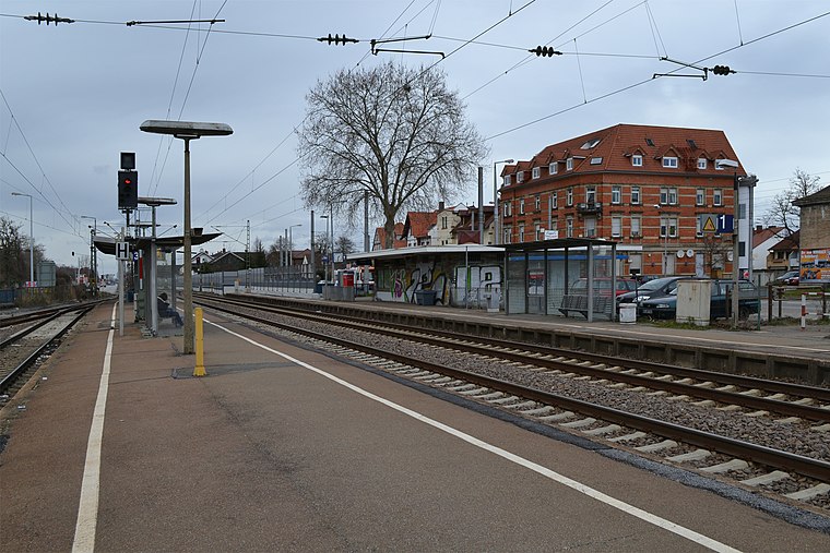
Photo: Telford, CC BY-SA 3.0.
Mannheim-Rheinau station is a railway station, which is situated 790 metres north of Imbiss-Pizzeria Da Gianni.
Places in the Area
Nearby places include Brühl and Altrip.
Brühl
Town

Photo: Frank-m, CC BY-SA 2.5.
Brühl is a municipality in the Rhein-Neckar district of Baden-Württemberg, Germany. The former fishing village along the Rhine has become a satellite of a growing Mannheim.
Altrip
Village

Photo: Immanuel Giel, Public domain.
Altrip is a municipality in the Rhein-Pfalz-Kreis, in Rhineland-Palatinate, Germany. It is situated on the left bank of the Rhine, approx. 7 km southeast of Ludwigshafen. The population in 2022 was 7,728. Altrip is situated 3½ km northwest of Imbiss-Pizzeria Da Gianni.
Grenzhof
Hamlet

Photo: 4028mdk09, CC BY-SA 3.0.
Grenzhof is a hamlet, which is situated 4 km east of Imbiss-Pizzeria Da Gianni.
Imbiss-Pizzeria Da Gianni
- Categories: food and restaurant
- Location: Mannheim, Karlsruhe Region, Rhine-Neckar, Baden-Württemberg, Germany, Central Europe, Europe
- View on OpenStreetMap
Latitude
49.41697° or 49° 25′ 1″ northLongitude
8.53811° or 8° 32′ 17″ eastOperator
ScopellitiOpen location code
8FXCCG8Q+Q6OpenStreetMap ID
node 2264160780OpenStreetMap feature
amenity=fast_foodOpenStreetMap attribute
cuisine=pizza
This page is based on OpenStreetMap, Wikidata, and Wikimedia Commons.
We’d love your help improving our open data sources. Thank you for contributing.
Satellite Map
Discover Imbiss-Pizzeria Da Gianni from above in high-definition satellite imagery.
Notable Places Nearby
Highlights include Art & more and SC Rot-Weiss Rheinau.
Nearby Places
Explore places such as Frobeniusstraße and Fahrschule Gardt.
Rhine-Neckar: Must-Visit Destinations
Delve into Heidelberg, Karlsruhe, Heilbronn, and Sinsheim.
Curious Fast Food Restaurants to Discover
Uncover intriguing fast food restaurants from every corner of the globe.
About Mapcarta. Data © OpenStreetMap contributors and available under the Open Database License". Text is available under the CC BY-SA 4.0 license, except for photos, directions, and the map. Photo: HubiB, CC BY 2.5.