Stop 63: Toorak Road
Stop 63: Toorak Road is a tram stop in Stonnington, Melbourne, Victoria. Stop 63: Toorak Road is situated nearby to the park Kooyong Gardens, as well as near Sir Robert Menzies Reserve.| Tap on a place to explore it |
Places of Interest Nearby
Highlights include Kooyong Stadium and Tooronga railway station.
Kooyong Stadium
Stadium
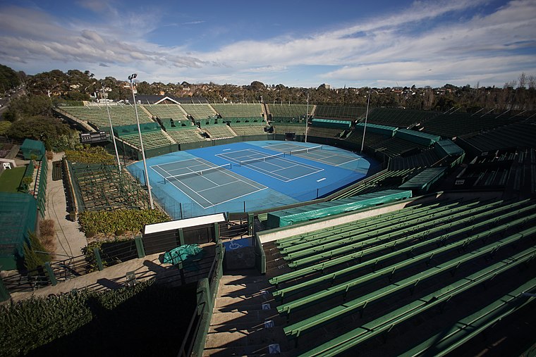
Photo: Brycewhite, CC BY-SA 4.0.
Kooyong Stadium, at the Kooyong Lawn Tennis Club, is an Australian tennis venue, located in the Melbourne suburb of Toorak, adjacent to the namesake suburb of Kooyong. Kooyong Stadium is situated 650 metres north of Stop 63: Toorak Road.
Tooronga railway station
Railway station

Photo: Jb17kx, CC BY-SA 3.0.
Tooronga station is a railway station operated by Metro Trains Melbourne on the Glen Waverley line, which is part of the Melbourne rail network. It serves the eastern suburb of Malvern, in Melbourne, Victoria, Australia. Tooronga railway station is situated 1 km southeast of Stop 63: Toorak Road.
Heyington railway station
Railway station

Photo: Ozzmosis, CC BY-SA 3.0.
Heyington station is a railway station operated by Metro Trains Melbourne on the Glen Waverley line, which is part of the Melbourne rail network. It serves the eastern suburb of Toorak, in Melbourne, Victoria, Australia. Heyington railway station is situated 1¼ km northwest of Stop 63: Toorak Road.
Places in the Area
Nearby places include Hawthorn East and St Kilda.
Hawthorn East
Suburb
Hawthorn East is a suburb of Melbourne, Victoria, Australia, 7 km east of the Melbourne central business district, located within the City of Boroondara local government area.
St Kilda

Photo: Tiimta, CC BY-SA 3.0.
St Kilda is a vibrant beachside suburb of Port Phillip, in south-eastern inner Melbourne, Australia. St. Kilda is famous for its beach life and the bar and restaurant scene along Fitzroy Street.
Inner east

Photo: Nicolás Boullosa, CC BY 2.0.
The inner east of Melbourne consists of a number of suburbs and localities within the Yarra municipality. Compared with glitzy Stonnington on the other side of the river, the inner eastern area is known among Melburnians as a working-class district, filled with pubs and old factories.
Stop 63: Toorak Road
- Type: Tram stop
- Categories: railway stop, transport stop, and transportation
- Location: Stonnington, Melbourne, Victoria, Australia, Oceania
- View on OpenStreetMap
Latitude
-37.84399° or 37° 50′ 38″ southLongitude
145.03149° or 145° 1′ 53″ eastOperator
Keolis DownerNetwork
Public Transport VictoriaOpen location code
4RJ7524J+CHOpenStreetMap ID
node 2274578290OpenStreetMap feature
public_transport=stop_positionOpenStreetMap feature
railway=tram_stop
This page is based on OpenStreetMap, Wikidata, and Wikimedia Commons.
We’d love your help improving our open data sources. Thank you for contributing.
Satellite Map
Discover Stop 63: Toorak Road from above in high-definition satellite imagery.
Notable Places Nearby
Highlights include Kooyong Gardens and Sir Robert Menzies Reserve.
Nearby Places
Explore places such as Stop 63: Toorak Road and Stop 139: Glenferrie Road.
Melbourne: Must-Visit Destinations
Delve into CBD, Eastern suburbs, Melbourne Airport, and Western suburbs.
Curious Tram Stops to Discover
Uncover intriguing tram stops from every corner of the globe.
About Mapcarta. Data © OpenStreetMap contributors and available under the Open Database License". Text is available under the CC BY-SA 4.0 license, except for photos, directions, and the map. Photo: Jorge Láscar, CC BY 2.0.