Pozzo presso Monrupino
Pozzo presso Monrupino is a cave in Trieste, Friuli-Venezia Giulia. Pozzo presso Monrupino is situated nearby to the cave Grotta SE di Monrupino, as well as near Grotta delle Colonne.| Tap on a place to explore it |
Places of Interest Nearby
Highlights include Riserva naturale regionale del Monte Orsario / Deželni naravni rezervat Medvedjak and Villa Opicina railway station.
Riserva naturale regionale del Monte Orsario / Deželni naravni rezervat Medvedjak
Nature reserve

Photo: Riccardo Zucco, CC BY-SA 4.0.
Riserva naturale regionale del Monte Orsario / Deželni naravni rezervat Medvedjak is a nature reserve.
Villa Opicina railway station
Railway station
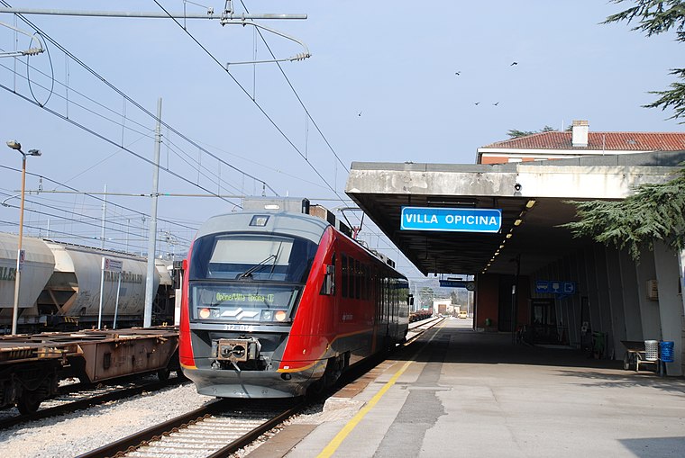
Photo: Pklos, CC BY-SA 4.0.
Villa Opicina railway station is situated 2 km southwest of Pozzo presso Monrupino.
Chiesa di Monrupino
Church

Photo: Tiesse, Public domain.
Chiesa di Monrupino is a church, which is situated 1½ km north of Pozzo presso Monrupino.
Places in the Area
Nearby places include Dol pri Vogljah and Opicina.
Dol pri Vogljah
Hamlet

Photo: Ajznponar, CC BY-SA 3.0.
Dol pri Vogljah is a settlement in the Municipality of Sežana in the Littoral region of Slovenia on the border with Italy.
Opicina
Town
Opicina, formerly Poggioreale del Carso in Italian, is a town in northeastern Italy, close to the Slovenian border at Fernetti. Opicina is a frazione of the comune of Trieste, the provincial and regional capital. Opicina is situated 2½ km southwest of Pozzo presso Monrupino.
Voglje
Hamlet

Photo: Ts918, CC BY-SA 4.0.
Voglje is a village in the Municipality of Sežana in the Littoral region of Slovenia right on the border with Italy. Voglje is situated 2½ km north of Pozzo presso Monrupino.
Pozzo presso Monrupino
- Type: Cave
- Category: landform
- Location: Trieste, Province of Trieste, Friuli-Venezia Giulia, Northeast Italy, Italy, Europe
- View on OpenStreetMap
Latitude
45.7054° or 45° 42′ 19″ northLongitude
13.80904° or 13° 48′ 33″ eastElevation
320 metres (1,050 feet)Open location code
8FQMPR45+5JOpenStreetMap ID
node 2274803970OpenStreetMap feature
natural=cave_entrance
This page is based on OpenStreetMap, Wikidata, and Wikimedia Commons.
We’d love your help improving our open data sources. Thank you for contributing.
Satellite Map
Discover Pozzo presso Monrupino from above in high-definition satellite imagery.
Notable Places Nearby
Highlights include Grotta SE di Monrupino and Grotta delle Colonne.
Nearby Places
Explore places such as Campi Solcati ‘M. Colognatti’ and Stagno di Percedol / Prčendol.
Friuli-Venezia Giulia: Must-Visit Destinations
Delve into Udine, Aquileia, Gorizia, and Pordenone.
Curious Caves to Discover
Uncover intriguing caves from every corner of the globe.
About Mapcarta. Data © OpenStreetMap contributors and available under the Open Database License". Text is available under the CC BY-SA 4.0 license, except for photos, directions, and the map. Photo: Dodos2013, CC BY-SA 3.0.