Le Dos D’Anne
Le Dos D’Anne is a fast food restaurant in Rumes, Arrondissement de Tournai, Wallonia. Le Dos D’Anne is situated nearby to the casino Le Golden Palace, as well as near the sports venue Cap Forme.| Tap on a place to explore it |
Places of Interest Nearby
Highlights include Église Saint-Pierre de Mouchin and Église Saint-Éloi de Bachy.
Église Saint-Pierre de Mouchin
Church

Photo: Peter17, CC BY-SA 3.0.
Église Saint-Pierre de Mouchin is a church, which is situated 1½ km south of Le Dos D’Anne.
Église Saint-Éloi de Bachy
Church

Photo: Codepem, CC BY-SA 3.0.
Église Saint-Éloi de Bachy is a church, which is situated 3 km northwest of Le Dos D’Anne.
Places in the Area
Nearby places include Howardries and Orchies.

Orchies
Village

Photo: Michielverbeek, CC BY-SA 3.0.
Orchies is a commune in the department of Nord in the Hauts-de-France region of French Flanders, northern France. Its inhabitants are called Orchésiens. Orchies is situated 7 km southwest of Le Dos D’Anne.
Carrefour de l’Arbre
Locality
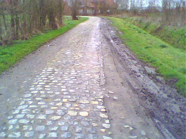
Photo: Wikimedia, CC BY-SA 3.0.
Carrefour de l'Arbre, officially Pavé de Luchin, is a 2.1 km cobbled road in the municipalities of Camphin-en-Pévèle, Baisieux-Sin and Gruson, in the Nord department of Northern France. Carrefour de l’Arbre is situated 8 km northwest of Le Dos D’Anne.
Le Dos D’Anne
- Type: Fast food restaurant
- Cuisine: friture
- Categories: food and restaurant
- Location: Rumes, Arrondissement de Tournai, Hainaut, Wallonia, Belgium, Benelux, Europe
- View on OpenStreetMap
Latitude
50.5317° or 50° 31′ 54″ northLongitude
3.28863° or 3° 17′ 19″ eastOpen location code
9F25G7JQ+MFOpenStreetMap ID
node 2282604503OpenStreetMap feature
amenity=fast_foodOpenStreetMap attribute
cuisine=friture
This page is based on OpenStreetMap, Wikidata, and Wikimedia Commons.
We’d love your help improving our open data sources. Thank you for contributing.
Satellite Map
Discover Le Dos D’Anne from above in high-definition satellite imagery.
Notable Places Nearby
Highlights include Le Golden Palace and Cap Forme.
Nearby Places
Explore places such as Au Pont de France and Station Lukoil.
Hainaut: Must-Visit Destinations
Delve into Charleroi, Mons, Tournai, and La Louvière.
Curious Fast Food Restaurants to Discover
Uncover intriguing fast food restaurants from every corner of the globe.
About Mapcarta. Data © OpenStreetMap contributors and available under the Open Database License". Text is available under the CC BY-SA 4.0 license, except for photos, directions, and the map. Photo: Herpoel, CC BY-SA 4.0.