westl. Mariengrotte
westl. Mariengrotte is in Dernbach, Südliche Weinstraße, Rhineland-Palatinate. westl. Mariengrotte is situated nearby to the scenic viewpoint Schöne Aussicht, as well as near the church Mariengrotte (Lourdesgrotte).| Tap on a place to explore it |
Places of Interest Nearby
Highlights include Neuscharfeneck Castle and Brushmakers’ Museum, Ramberg.
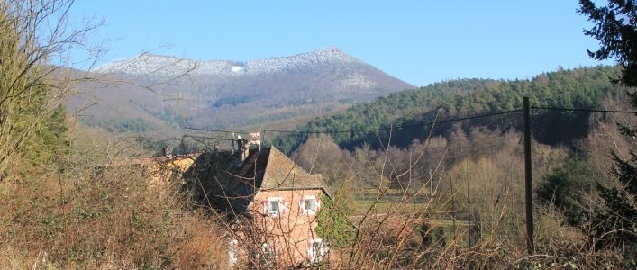
Neuscharfeneck Castle
Castle

Photo: Dokape, CC BY-SA 3.0.
The castle of Neuscharfeneck is a ruin and a cultural monument above Ramberg and Dernbach on the territory of an exclave of Flemlingen in the district of Südliche Weinstraße in the west German state of Rhineland-Palatinate. Neuscharfeneck Castle is situated 1 km east of westl. Mariengrotte.
Brushmakers’ Museum, Ramberg
Museum

Photo: H. Schreiber, CC BY-SA 3.0.
The Brushmakers' Museum in Ramberg is a local history museum in the village of Ramberg in the German state of Rhineland-Palatinate. The responsible body that set the museum up in 1997 and has run it since then is the Local History and Museum Society of the Brushmakers' Workshop, Ramber. Brushmakers’ Museum, Ramberg is situated 1 km north of westl. Mariengrotte.
Orensberg
Peak

Photo: Steffen 962, CC0.
The Orensberg, also known in the region as the Orensfels due to the striking rock formations on its summit plateau, is a hill, 581.2 m above sea level, near Frankweiler in the county of Südliche Weinstraße in the German state of Rhineland-Palatinate.
Places in the Area
Nearby places include Ramberg and Vogelstockerhof.
Ramberg
Village

Photo: Gerd Eichmann, CC BY-SA 4.0.
Ramberg is a municipality in Südliche Weinstraße district, in Rhineland-Palatinate, western Germany.
Eußerthal
Village

Photo: Gerd Eichmann, CC BY-SA 4.0.
Eußerthal is a municipality in the Südliche Weinstraße district of Rhineland-Palatinate, Germany. Eußerthal is situated 3 km southwest of westl. Mariengrotte.
westl. Mariengrotte
- Type: Sign
- Categories: information and tourism
- Location: Dernbach, Südliche Weinstraße, Rhineland-Palatinate, Germany, Central Europe, Europe
- View on OpenStreetMap
Latitude
49.25165° or 49° 15′ 6″ northLongitude
8.00935° or 8° 0′ 34″ eastElevation
256 metres (840 feet)Open location code
8FXC7225+MPOpenStreetMap ID
node 2297314116OpenStreetMap feature
tourism=information
This page is based on OpenStreetMap, Wikidata, and Wikimedia Commons.
We’d love your help improving our open data sources. Thank you for contributing.
Satellite Map
Discover westl. Mariengrotte from above in high-definition satellite imagery.
Notable Places Nearby
Highlights include Schöne Aussicht and Mariengrotte (Lourdesgrotte).
Nearby Places
Explore places such as Gnadenbild Unserer lieben Frau, genannt Marien- oder Lourdesgrotte and Der Marktweg - Wandern auf historischen Pfaden.
Rhineland-Palatinate: Must-Visit Destinations
Delve into Mainz, Trier, Koblenz, and Worms.
Curious Places to Discover
Uncover intriguing places from every corner of the globe.
About Mapcarta. Data © OpenStreetMap contributors and available under the Open Database License". Text is available under the CC BY-SA 4.0 license, except for photos, directions, and the map. Photo: Traveler100, CC BY-SA 3.0.