Slip Gallery
Slip Gallery is a recording studio in King County, Puget Sound, Washington which is located on 1st Avenue. Slip Gallery is situated nearby to the apartment building Barnes Building, as well as near Bell Apartments.| Tap on a place to explore it |
- Email: slipbelltown@gmail.com
- Type: Recording studio
- Address: 2301 1st Avenue, Seattle, WA 98121
Places of Interest Nearby
Highlights include Space Needle and Bell Street Park.
Space Needle
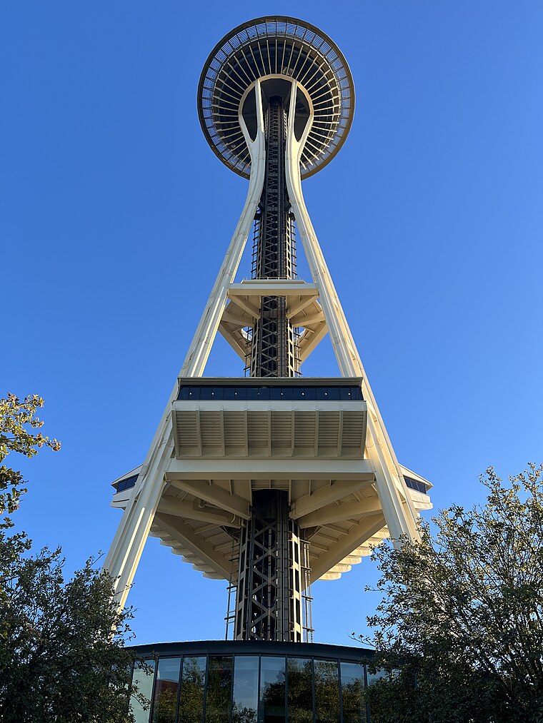
Photo: Another Believer, CC BY-SA 4.0.
The Space Needle is an observation tower in Seattle, Washington, United States. Considered to be an icon of the city, it has been designated a Seattle landmark. Space Needle is situated 2,700 feet north of Slip Gallery.
Bell Street Park
Park

Photo: LittleT889, CC BY-SA 4.0.
Bell Street Park is a 1.33-acre park, created in 2014 in Seattle, Washington's Belltown neighborhood. Situated in a neighborhood described as a former "hot-spot for low-level crime, drug-dealing and civil disorder", and intended in part to reduce crime rates… Bell Street Park is situated 690 feet northeast of Slip Gallery.
Pike Place Market

Photo: Wac, CC BY-SA 1.0.
Pike Place Market is a public market in Seattle, Washington, United States. It opened on August 17, 1907, and is one of the older continuously operated public farmers' markets in the United States. Pike Place Market is situated 1,900 feet southeast of Slip Gallery.
Places in the Area
Nearby places include Belltown and Uptown.
Belltown
Suburb

Photo: Jmabel, CC BY-SA 3.0.
Belltown is the most densely populated neighborhood in Seattle, Washington, United States, located on the city's downtown waterfront on land that was artificially flattened as part of a regrading project.
Uptown
Neighborhood

Photo: Wknight94, CC BY-SA 3.0.
Lower Queen Anne is a neighborhood in northwestern Seattle, Washington, at the base of Queen Anne Hill. While its boundaries are not precise, the toponym usually refers to the shopping, office, and residential districts to the north and west of Seattle Center.
South Lake Union
Neighborhood

Photo: Jmabel, CC BY-SA 4.0.
South Lake Union is a neighborhood in central Seattle, Washington, so named because it is at the southern tip of Lake Union. The official boundaries of the City of Seattle Urban Center are Denny Way on the south, beyond which is Denny Triangle; Interstate…
Slip Gallery
Latitude
47.61336° or 47° 36′ 48″ northLongitude
-122.34678° or 122° 20′ 48″ westOpen location code
84VVJM73+87OpenStreetMap ID
node 2327663052OpenStreetMap feature
amenity=studio
This page is based on OpenStreetMap, Wikidata, and Wikimedia Commons.
We’d love your help improving our open data sources. Thank you for contributing.
Satellite Map
Discover Slip Gallery from above in high-definition satellite imagery.
Notable Places Nearby
Highlights include Barnes Building and Bell Apartments.
Nearby Places
Explore places such as The Oregon Apartments and The Grill from Ipanema.
King County: Must-Visit Destinations
Delve into Seattle, Bellevue, Seattle-Tacoma International Airport, and Capitol Hill-Central District.
Curious Recording Studios to Discover
Uncover intriguing recording studios from every corner of the globe.
About Mapcarta. Data © OpenStreetMap contributors and available under the Open Database License". Text is available under the CC BY-SA 4.0 license, except for photos, directions, and the map. Photo: Lumpytrout, CC BY-SA 3.0.