Vitry-sur-Seine - Voie 2B
Vitry-sur-Seine - Voie 2B is a railway stop in Vitry-sur-Seine, Arrondissement of L’Haÿ-les-Roses, Île-de-France. Vitry-sur-Seine - Voie 2B is situated nearby to the railway station Vitry-sur-Seine station, as well as near Gare de Vitry-sur-Seine.| Tap on a place to explore it |
Places of Interest Nearby
Highlights include Vitry-sur-Seine station and Institut polytechnique des sciences avancées.
Vitry-sur-Seine station
Railway station

Photo: Geralix, CC BY-SA 3.0.
Vitry-sur-Seine is a station in Paris's express suburban rail system, the RER. It is on the Paris–Bordeaux railway. It serves the commune of Vitry-sur-Seine, in the Val-de-Marne department.
Institut polytechnique des sciences avancées
College

Photo: Marieforchance, CC0.
The Institut Polytechnique des Sciences Avancées, is a French private grande école in aerospace engineering located at Ivry-sur-Seine, Lyon and Toulouse, recognized by the French state since 2010, whose diploma has been accredited by the French Commission des Titres d'Ingénieur since 2011. Institut polytechnique des sciences avancées is situated 1½ km north of Vitry-sur-Seine - Voie 2B.
Paul Vaillant-Couturier - Gare RER
Bike rental

Photo: Chabe01, CC BY-SA 4.0.
Paul Vaillant-Couturier - Gare RER is a bike rental.
Places in the Area
Nearby places include Alfortville and Ivry-sur-Seine.
Alfortville
Town
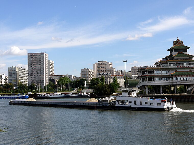
Photo: Pline, CC BY-SA 3.0.
Alfortville is a commune in the Val-de-Marne department in the southeastern suburbs of Paris, France. It is located 7.6 km from the center of Paris. It is one of the 13 communes in the intercommunality of Métropole du Grand Paris.
Ivry-sur-Seine
Town
 Ivry-sur-Seine is a commune in the Val-de-Marne department in the southeastern suburbs of Paris, France. It is located 5.3 km from the centre of Paris.
Maisons-Alfort
Town
Photo: Chabe01, CC BY-SA 4.0.
Maisons-Alfort is a commune in the southeastern suburbs of Paris, France. It is located 8.4 km from the centre of Paris. Maisons-Alfort is famous as the location of the National Veterinary School of Alfort.
Vitry-sur-Seine - Voie 2B
- Type: Railway stop
- Categories: transport stop and transportation
- Location: Vitry-sur-Seine, Arrondissement of L’Haÿ-les-Roses, Val-de-Marne, Île-de-France, France, Europe
- View on OpenStreetMap
Latitude
48.8006° or 48° 48′ 2″ northLongitude
2.4024° or 2° 24′ 9″ eastOpen location code
8FW4RC22+6XOpenStreetMap ID
node 2356380622OpenStreetMap feature
public_transport=stop_positionOpenStreetMap feature
railway=stop
This page is based on OpenStreetMap, Wikidata, and Wikimedia Commons.
We’d love your help improving our open data sources. Thank you for contributing.
Satellite Map
Discover Vitry-sur-Seine - Voie 2B from above in high-definition satellite imagery.
Notable Places Nearby
Highlights include Gare de Vitry-sur-Seine and La station danse.
Nearby Places
Explore places such as Guichet Transilien and Vitry-sur-Seine - Voie 1B.
Île-de-France: Must-Visit Destinations
Delve into Paris, Versailles, Boulogne-Billancourt, and Paris Charles de Gaulle Airport.
Curious Railway Stops to Discover
Uncover intriguing railway stops from every corner of the globe.
About Mapcarta. Data © OpenStreetMap contributors and available under the Open Database License". Text is available under the CC BY-SA 4.0 license, except for photos, directions, and the map. Photo: Guillaume Baviere, CC BY 2.0.