Rad’s Barbers
Rad’s Barbers is a hairdresser in Windsor and Maidenhead, England. Rad’s Barbers is situated nearby to Methodist Church, as well as near Maidenhead Post Office.| Tap on a place to explore it |
Places of Interest Nearby
Highlights include Maidenhead railway station and Odeon Maidenhead.
Maidenhead railway station
Railway station

Photo: Geof Sheppard, CC BY-SA 4.0.
Maidenhead railway station serves the market town of Maidenhead, Berkshire, England. It is 24 miles 19 chains down the line from London Paddington and is situated between Taplow to the east and Twyford to the west. Maidenhead railway station is situated 1,500 feet south of Rad’s Barbers.
Odeon Maidenhead
Movie theater

Photo: Graham Horn, CC BY-SA 2.0.
Odeon Maidenhead is a movie theater, which is situated 680 feet south of Rad’s Barbers.
Maidenhead Town Hall
Town hall

Photo: Graham Horn, CC BY-SA 2.0.
Maidenhead Town Hall is a municipal building in St Ives Road, Maidenhead, Berkshire, England. Maidenhead Town Hall is situated 1,100 feet east of Rad’s Barbers.
Places in the Area
Nearby places include Maidenhead and Braywick.
Maidenhead
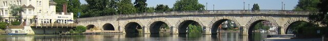
Photo: Nigel Cox, CC BY-SA 2.0.
Maidenhead is a large riverside town in the county of Berkshire in the South East of England. Like many towns, Maidenhead has lost some of its historic charm, and the town centre is a little uninspiring and overdeveloped in some parts.
Braywick
Suburb

Photo: Nigel Cox, CC BY-SA 2.0.
Braywick is a linear suburb south of the town of Maidenhead in Berkshire, England. It was formerly part of the parish of Bray.
Glen Island
Locality

Photo: Nancy, CC BY-SA 3.0.
Glen Island is a large area of land between the head of the Jubilee River and the River Thames at Boulter's Lock near Maidenhead. The Grade II listed Glen Island House, a riverside Gentleman's residence, was built in 1869 for Lt.
Rad’s Barbers
- Type: Hairdresser
- Category: shop
- Location: Windsor and Maidenhead, England, United Kingdom, Britain and Ireland, Europe
- View on OpenStreetMap
Latitude
51.52249° or 51° 31′ 21″ northLongitude
-0.72353° or 0° 43′ 25″ westOpen location code
9C3XG7CG+XHOpenStreetMap ID
node 2364966126OpenStreetMap feature
shop=hairdresser
This page is based on OpenStreetMap, Wikidata, and Wikimedia Commons.
We’d love your help improving our open data sources. Thank you for contributing.
Satellite Map
Discover Rad’s Barbers from above in high-definition satellite imagery.
Notable Places Nearby
Highlights include Methodist Church and Maidenhead Post Office.
Nearby Places
Explore places such as Funtech and Kings Lettings.
England: Must-Visit Destinations
Delve into London, Manchester, Sheffield, and Leeds.
Curious Hairdressers to Discover
Uncover intriguing hairdressers from every corner of the globe.
About Mapcarta. Data © OpenStreetMap contributors and available under the Open Database License". Text is available under the CC BY-SA 4.0 license, except for photos, directions, and the map. Photo: sidibousaid, CC BY 2.0.