Wat Pan Sat
Wat Pan Sat is a ruins in Chang Phueak, Mueang Chiang Mai, Chiang Mai Province. Wat Pan Sat is situated nearby to Chang Phuak Bus Station, as well as near the bus station Yellow Songthaew stop to Chomthong.| Tap on a place to explore it |
Places of Interest Nearby
Highlights include Wat Ku Tao and Thep Montien.
Wat Ku Tao
Buddhist temple

Photo: Ariya 95, CC BY-SA 3.0.
Wat Ku Tao is a Buddhist temple in Chiang Mai, Thailand. The temple was built in 1613 to enshrine the remains of Nawrahta Minsaw, the first Burmese ruler of Lan Na. Wat Ku Tao is situated 290 metres northeast of Wat Pan Sat.
Thep Montien
Buddhist temple

Photo: DerFussi, CC BY-SA 3.0.
Thep Montien is a Buddhist temple, which is situated 390 metres east of Wat Pan Sat.
Wat Chiang Yuen
Buddhist temple
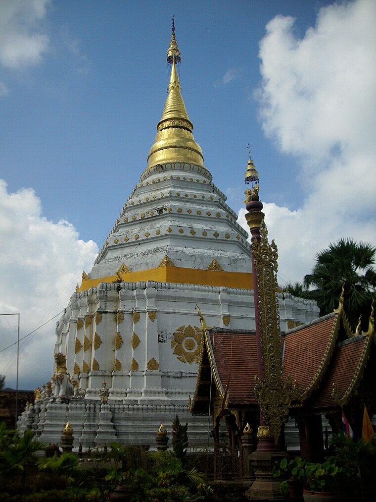
Photo: Јованвб, CC BY-SA 3.0.
Wat Chiang Yuen is a Buddhist temple in Chiang Mai, Thailand, located north of the Old City, about 600 metres east of Wat Lok Moli. First built in 1500s, Lanna kings historically paid homage to the Phra Suppunyu Chao Buddha image at the temple before their coronation. Wat Chiang Yuen is situated 490 metres south of Wat Pan Sat.
Places in the Area
Nearby places include Chiang Mai and Chang Phueak.
Chiang Mai

Photo: Tevaprapas, CC BY 3.0.
Chiang Mai is the hub of northern Thailand. On a plain at an elevation of 316 m, surrounded by mountains and lush countryside, it is much greener and quieter than the capital and has a cosmopolitan air and a significant expatriate population, all factors which have led many from Bangkok to settle permanently in this "rose of the north".
Chang Phueak
Town
Chang Phueak is a tambon of Mueang Chiang Mai District, in Chiang Mai Province, Thailand. The tambon is home to the Chiang Mai National Museum, which traces northern Thai history and culture.
Nong Pa Khrang
Town
Nong Pa Khrang is a tambon of Mueang Chiang Mai District, in Chiang Mai Province, Thailand. In 2005 it had a population of 8,423 people. The tambon contains seven mubans. Nong Pa Khrang is situated 4½ km east of Wat Pan Sat.
Wat Pan Sat
- Type: Ruins
- Category: historic site
- Location: Chang Phueak, Mueang Chiang Mai, Chiang Mai Province, Northern Thailand, Thailand, Southeast Asia, Asia
- View on OpenStreetMap
Latitude
18.8004° or 18° 48′ 1″ northLongitude
98.98703° or 98° 59′ 13″ eastOpen location code
7MCWRX2P+5ROpenStreetMap ID
node 2420202264OpenStreetMap feature
historic=ruins
This page is based on OpenStreetMap, Wikidata, and Wikimedia Commons.
We’d love your help improving our open data sources. Thank you for contributing.
Satellite Map
Discover Wat Pan Sat from above in high-definition satellite imagery.
In Other Languages
“Wat Pan Sat” goes by many names.
- Thai: “วัดปันสาท”
Notable Places Nearby
Highlights include Chang Phuak Bus Station and Yellow Songthaew stop to Chomthong.
Nearby Places
Explore places such as 7-Eleven and Chang Phuak Bus Station.
Chiang Mai Province: Must-Visit Destinations
Delve into Chiang Mai, Samoeng, Chiang Dao, and Doi Inthanon National Park.
Curious Ruins to Discover
Uncover intriguing ruins from every corner of the globe.
About Mapcarta. Data © OpenStreetMap contributors and available under the Open Database License". Text is available under the CC BY-SA 4.0 license, except for photos, directions, and the map. Photo: Gudesign, CC BY-SA 3.0.