Site of Ipstones station
Site of Ipstones station is in Ipstones, Staffordshire Moorlands, England. Site of Ipstones station is situated nearby to the peak Summer Hill, as well as near the forest RSPB Coombes Valley.| Tap on a place to explore it |
Places of Interest Nearby
Highlights include Peak Wildlife Park and Church of St Leonard.
Peak Wildlife Park
Zoo

Photo: Mike Peel, CC BY-SA 4.0.
Peak Wildlife Park is a zoo in central England. The nearest towns are Leek, Ashbourne and Stoke-on-Trent. The zoo was originally known as Blackbrook Zoological Park, but entered administration in 2014 and closed. Peak Wildlife Park is situated 1¼ miles east of Site of Ipstones station.
Church of St Leonard
Church

Photo: Alan Murray-Rust, CC BY-SA 2.0.
Church of St Leonard is situated 1½ miles southwest of Site of Ipstones station.
Winkhill railway station
Winkhill railway station was a railway station that served the hamlet of Winkhill, Staffordshire. It was opened by the North Staffordshire Railway in 1910 and closed to passenger use in 1935, but remained open to freight traffic until 1964. Winkhill railway station is situated 2 miles southeast of Site of Ipstones station.Places in the Area
Nearby places include Ipstones and Whiston.
Ipstones
Village
Photo: Alan Murray-Rust, CC BY-SA 2.0.
Ipstones is a village and civil parish in the north of the English county of Staffordshire. Ipstones is part of the Staffordshire Moorlands district; within the boundaries of the civil parish are the hamlets Foxt, Consall Forge and Bottomhouse.
Whiston
Village
Whiston is a village in the Staffordshire Moorlands district of Staffordshire, England. Population details as taken at the 2011 census can be found under Kingsley. It is located within the Churnet Valley on the A52 road east of the village of Froghall. Whiston is situated 3 miles south of Site of Ipstones station.
Waterfall
Village
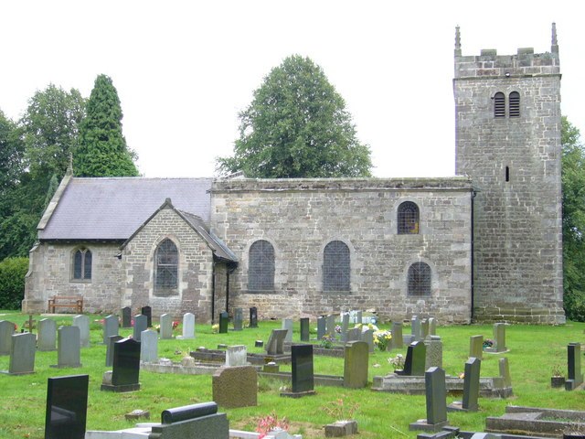
Photo: Roger W Haworth, CC BY-SA 2.0.
Waterfall is a village, which is situated 3 miles east of Site of Ipstones station.
Site of Ipstones station
- Type: Tourism
- Category: tourist attraction
- Location: Ipstones, Staffordshire Moorlands, Staffordshire, West Midlands, England, United Kingdom, Britain and Ireland, Europe
- View on OpenStreetMap
Latitude
53.06611° or 53° 3′ 58″ northLongitude
-1.95586° or 1° 57′ 21″ westOpen location code
9C5W328V+CMOpenStreetMap ID
node 2434351640OpenStreetMap feature
tourism=heritage_railway
This page is based on OpenStreetMap, Wikidata, and Wikimedia Commons.
We’d love your help improving our open data sources. Thank you for contributing.
Satellite Map
Discover Site of Ipstones station from above in high-definition satellite imagery.
Notable Places Nearby
Highlights include Summer Hill and RSPB Coombes Valley.
Nearby Places
Explore places such as Bottom Lane Farm and Butcher’s Tenement.
Staffordshire: Must-Visit Destinations
Delve into Stoke-on-Trent, Lichfield, Stafford, and Tamworth.
Curious Places to Discover
Uncover intriguing places from every corner of the globe.
About Mapcarta. Data © OpenStreetMap contributors and available under the Open Database License". Text is available under the CC BY-SA 4.0 license, except for photos, directions, and the map. Photo: Wikimedia, CC0.