Brèche de l’Autaret / Colle di Ciabrera
Brèche de l’Autaret / Colle di Ciabrera is a mountain saddle in Saint-Paul-sur-Ubaye, Arrondissement of Barcelonnette, Provence-Alpes-Côte d’Azur and has an elevation of 2,914 metres. Brèche de l’Autaret / Colle di Ciabrera is situated nearby to the locality Chiutas, as well as near Le Barricate.| Tap on a place to explore it |
Places of Interest
Highlights include Pelvo di Ciabrera and Monte Maniglia.
Pelvo di Ciabrera
Peak

Photo: Luca Bergamasco, CC BY 3.0.
The Pelvo di Ciabrera is a mountain in the Cottian Alps, located on the main Alpine watershed between the Valle Varaita di Bellino and the Ubaye Valley.
Monte Maniglia
Peak
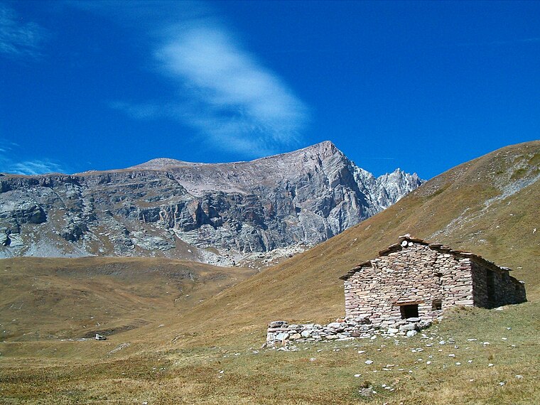
Photo: Luca Bergamasco, CC BY 3.0.
Monte Maniglia is a mountain in the Cottian Alps, located on the border between Italy and France, between Piedmont and the Alpes-de-Haute-Provence.

Brèche de l’Autaret / Colle di Ciabrera
- Type: Mountain saddle with an elevation of 2,914 metres
- Category: landform
- Location: Saint-Paul-sur-Ubaye, Arrondissement of Barcelonnette, Alpes-de-Haute-Provence, Provence-Alpes-Côte d’Azur, France, Europe
- View on OpenStreetMap
Latitude
44.5758° or 44° 34′ 33″ northLongitude
6.9335° or 6° 56′ 1″ eastElevation
2,914 metres (9,560 feet)Open location code
8FP8HWGM+89OpenStreetMap ID
node 2448532719OpenStreetMap feature
natural=saddle
This page is based on OpenStreetMap, Wikidata, and Wikimedia Commons.
We’d love your help improving our open data sources. Thank you for contributing.
Satellite Map
Discover Brèche de l’Autaret / Colle di Ciabrera from above in high-definition satellite imagery.
In Other Languages
From French to Italian—“Brèche de l’Autaret / Colle di Ciabrera” goes by many names.
- French: “Brèche de l’Autaret”
- Italian: “Colle di Ciabrera”
Localities in the Area
Explore places such as Chiutas and Le Barricate.
Notable Places Nearby
Highlights include Col de l’Autaret / Colle dell’Autaret and Pelvat de Chabrière sommet ouest.
Alpes-de-Haute-Provence: Must-Visit Destinations
Delve into Manosque, Sisteron, Moustiers Sainte Marie, and Annot.
Curious Mountain Saddles to Discover
Uncover intriguing mountain saddles from every corner of the globe.
About Mapcarta. Data © OpenStreetMap contributors and available under the Open Database License". Text is available under the CC BY-SA 4.0 license, except for photos, directions, and the map. Photo: Wikimedia, CC BY-SA 3.0.