Be Burger Ixelles
Be Burger Ixelles is a fast food restaurant in Brussels, Belgium. Be Burger Ixelles is situated nearby to the theater building Kings of Comedy Club, as well as near the recreation area L’orchidée blanche.| Tap on a place to explore it |
- Opening hours:
Sunday—Wednesday: 11:30 AM—10:00 PM
Thursday—Saturday: 11:30 AM—10:30 PM - Email: ixelles@beburger.be
- Type: Fast food restaurant
- Cuisine: burger
- Wheelchair access: limited
Places of Interest Nearby
Highlights include Ixelles Cemetery and Etterbeek railway station.
Ixelles Cemetery
Cemetery
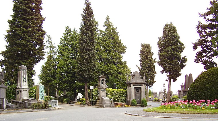
Photo: Ben2, CC BY-SA 3.0.
Ixelles Cemetery, located in Ixelles in the southern part of Brussels, is one of the major cemeteries in Belgium. Ixelles Cemetery also refers to a neighbourhood with a lot of bars and restaurants for students, north of the actual cemetery. Ixelles Cemetery is situated 280 metres east of Be Burger Ixelles.
Etterbeek railway station
Railway station

Photo: Japplemedia, CC BY-SA 4.0.
Etterbeek railway station is a railway station in Brussels, Belgium, operated by the National Railway Company of Belgium. The station is named after the municipality of Etterbeek, though it is located in neighbouring Ixelles, at the Couronne/Kroon crossroad on the Greater Ring. Etterbeek railway station is situated 690 metres north of Be Burger Ixelles.
Embassy of the United Arab Emirates
Government office

Photo: Pymouss, CC BY-SA 4.0.
Embassy of the United Arab Emirates is a government office, which is situated 1 km southwest of Be Burger Ixelles.
Places in the Area
Nearby places include Solbosch - Solbos and Usquare.


Boondael - Boondaal
Neighborhood

Photo: Waelsch, CC BY-SA 3.0.
Boondael - Boondaal is a neighborhood.
Be Burger Ixelles
- Categories: food and restaurant
- Location: Brussels, Arrondissement of Brussels-Capital, Brussels, Brussels Capital, Belgium, Benelux, Europe
- View on OpenStreetMap
Latitude
50.81588° or 50° 48′ 57″ northLongitude
4.38957° or 4° 23′ 23″ eastOpen location code
9F26R98Q+9ROpenStreetMap ID
node 2468879166OpenStreetMap feature
amenity=fast_foodOpenStreetMap attribute
cuisine=burgerOpenStreetMap attribute
wheelchair=limited
This page is based on OpenStreetMap, Wikidata, and Wikimedia Commons.
We’d love your help improving our open data sources. Thank you for contributing.
Satellite Map
Discover Be Burger Ixelles from above in high-definition satellite imagery.
Notable Places Nearby
Highlights include Kings of Comedy Club and L’orchidée blanche.
Nearby Places
Explore places such as Hawaiian Poké Bowl and My Tannour Cimdix.
Brussels: Must-Visit Destinations
Delve into Pentagon, Brussels Airport, Schaarbeek, and Centre.
Curious Fast Food Restaurants to Discover
Uncover intriguing fast food restaurants from every corner of the globe.
About Mapcarta. Data © OpenStreetMap contributors and available under the Open Database License". Text is available under the CC BY-SA 4.0 license, except for photos, directions, and the map. Photo: Hullie, CC BY-SA 3.0.