Vespro di sopra
Vespro di sopra is a locality in Bibbiena, Arezzo, Tuscany. Vespro di sopra is situated nearby to the locality Pianacci, as well as near Sodina.| Tap on a place to explore it |
Places of Interest
Highlights include Santuario della Verna and Castello di Gressa.
Santuario della Verna
Monastery
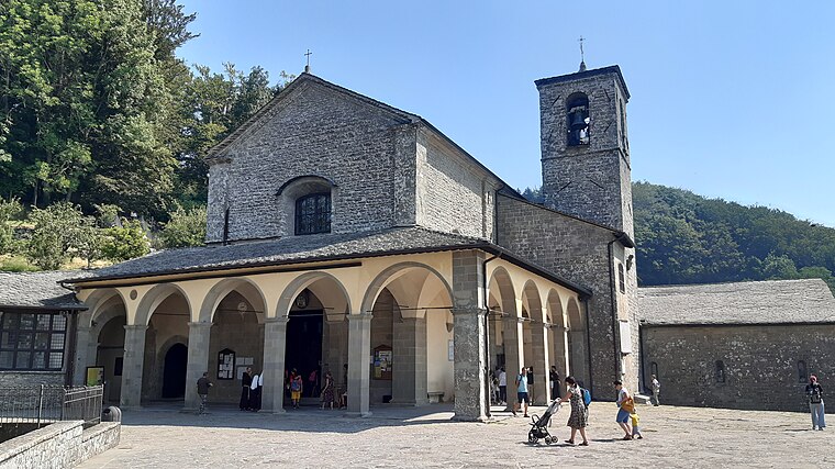
Photo: Tulumnes, CC BY-SA 4.0.
Santuario della Verna is a monastery, which is situated 3½ km east of Vespro di sopra.
Castello di Gressa
Castle
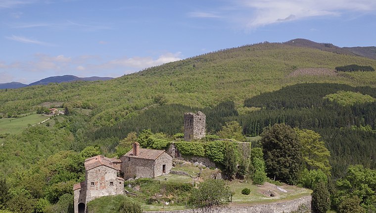
Photo: Maxcivi, CC BY-SA 4.0.
Castello di Gressa is a castle, which is situated 4 km west of Vespro di sopra.
Places in the Area
Nearby places include La Verna and Chiusi della Verna.
La Verna
Hamlet

Photo: Wikimedia, Public domain.
La Verna is a locality on Mount Penna, an isolated mountain of 1,283 metres situated in the centre of the Tuscan Apennines, rising above the valley of the Casentino, central Italy. La Verna is situated 3½ km east of Vespro di sopra.
Chiusi della Verna
Village
 Chiusi della Verna is a comune in the Province of Arezzo in the Italian region Tuscany, located about 60 kilometres east of Florence and about 25 kilometres north of Arezzo. Chiusi della Verna is situated 5 km southeast of Vespro di sopra.
Corezzo
Hamlet

Photo: Ilpinguinotransalpino, CC BY-SA 4.0.
Corezzo is a hamlet, which is situated 6 km northeast of Vespro di sopra.
Vespro di sopra
- Type: Locality
- Location: Bibbiena, Arezzo, Tuscany, Central Italy, Italy, Europe
- View on OpenStreetMap
Latitude
43.71941° or 43° 43′ 10″ northLongitude
11.88991° or 11° 53′ 24″ eastOpen location code
8FMHPV9Q+QXOpenStreetMap ID
node 2498439794OpenStreetMap feature
place=locality
This page is based on OpenStreetMap, Wikidata, and Wikimedia Commons.
We’d love your help improving our open data sources. Thank you for contributing.
Satellite Map
Discover Vespro di sopra from above in high-definition satellite imagery.
Localities in the Area
Explore places such as Pianacci and Sodina.
Notable Places Nearby
Highlights include Cimitero di Moscaio and Chiesa di San Donato.
Arezzo: Must-Visit Destinations
Delve into Arezzo, Cortona, Poppi, and Montevarchi.
Curious Localities to Discover
Uncover intriguing localities from every corner of the globe.
About Mapcarta. Data © OpenStreetMap contributors and available under the Open Database License". Text is available under the CC BY-SA 4.0 license, except for photos, directions, and the map. Photo: Wikimedia, CC0.