Créteil-Pompadour RER
Créteil-Pompadour RER is a bus stop in Créteil, Val-de-Marne, Île-de-France. Créteil-Pompadour RER is situated nearby to the railway station Créteil Pompadour station, as well as near Créteil-Pompadour Railway Station.| Tap on a place to explore it |
Places of Interest Nearby
Highlights include Créteil Pompadour station and Hôtel de Ville.
Créteil Pompadour station
Railway station

Photo: Poudou99, CC BY-SA 3.0.
Créteil Pompadour station is a railway station located in Créteil, a suburb south of Paris, France. The station was opened on 15 December 2013 and is located on the Paris–Marseille railway. Créteil Pompadour station is situated 160 metres south of Créteil-Pompadour RER.
Hôtel de Ville
Town hall

Photo: Spiritia, Copyrighted free use.
The Hôtel de Ville is a municipal building in Créteil, Val-de-Marne, in the southeast suburbs of Paris, France, standing on Place Salvador-Allende. Hôtel de Ville is situated 1½ km east of Créteil-Pompadour RER.
Le Vert de Maisons station
Railway station

Photo: Wikimedia, CC BY-SA 3.0.
Le Vert de Maisons is a railway station in Maisons-Alfort and Alfortville, Val-de-Marne, Île-de-France, France. The station was opened on 28 May 1955 and is on the Paris–Marseille railway. Le Vert de Maisons station is situated 2 km north of Créteil-Pompadour RER.
Places in the Area
Nearby places include Créteil and Choisy-le-Roi.
Créteil
Town

Photo: Paul Fleury, CC BY 3.0.
Créteil is a commune in the southeastern suburbs of Paris, Île-de-France. It is located 11.7 km from the centre of Paris. Créteil is the préfecture of the Val-de-Marne department as well as the seat of the Arrondissement of Créteil.
Choisy-le-Roi
Town

Photo: 1quidam, CC BY-SA 3.0.
Choisy-le-Roi is a commune in the Val-de-Marne department, in the southeastern suburbs of Paris, Île-de-France.
Maisons-Alfort
Town
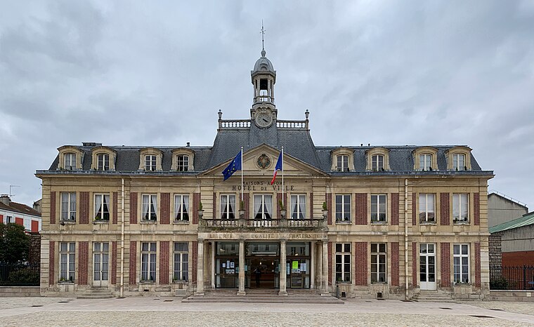
Photo: Chabe01, CC BY-SA 4.0.
Maisons-Alfort is a commune in the southeastern suburbs of Paris, France. It is located 8.4 km from the center of Paris. Maisons-Alfort is famous as the location of the National Veterinary School of Alfort. Maisons-Alfort is situated 3 km north of Créteil-Pompadour RER.
Créteil-Pompadour RER
- Type: Bus stop
- Categories: transport stop and transportation
- Location: Créteil, Arrondissement of Créteil, Val-de-Marne, Île-de-France, France, Europe
- View on OpenStreetMap
Latitude
48.77302° or 48° 46′ 23″ northLongitude
2.43484° or 2° 26′ 5″ eastOpen location code
8FW4QCFM+6WOpenStreetMap ID
node 2565112077OpenStreetMap feature
public_transport=stop_position
This page is based on OpenStreetMap, Wikidata, and Wikimedia Commons.
We’d love your help improving our open data sources. Thank you for contributing.
Satellite Map
Discover Créteil-Pompadour RER from above in high-definition satellite imagery.
Notable Places Nearby
Highlights include Créteil-Pompadour Railway Station and Parc interdépartemental des sports Paris Val-de-Marne.
Nearby Places
Explore places such as Créteil-Pompadour RER and Créteil Pompadour.
Île-de-France: Must-Visit Destinations
Delve into Paris, Versailles, Boulogne-Billancourt, and Paris Charles de Gaulle Airport.
Curious Bus Stops to Discover
Uncover intriguing bus stops from every corner of the globe.
About Mapcarta. Data © OpenStreetMap contributors and available under the Open Database License". Text is available under the CC BY-SA 4.0 license, except for photos, directions, and the map. Photo: Guillaume Baviere, CC BY 2.0.