Avenue et Fort de Montrouge
Avenue et Fort de Montrouge is a bus stop in Arcueil, Arrondissement of L’Haÿ-les-Roses, Île-de-France. Avenue et Fort de Montrouge is situated nearby to the pitch Terrain n°13, as well as near Terrain n°12.| Tap on a place to explore it |
Places of Interest Nearby
Highlights include Montrouge fort and Barbara station.
Montrouge fort
Military installation

Photo: Ralf.treinen, CC BY-SA 3.0.
Montrouge fort is a military installation, which is situated 240 metres southwest of Avenue et Fort de Montrouge.
Barbara station
Metro station

Photo: Chabe01, CC BY-SA 4.0.
Barbara is a station of the Paris Métro on Line 4 in Montrouge and Bagneux. The station was built as part of a two-station southward extension from Mairie de Montrouge to Bagneux–Lucie Aubrac. It opened in January 2022. Barbara station is situated 400 metres west of Avenue et Fort de Montrouge.
Laplace station
Railway station
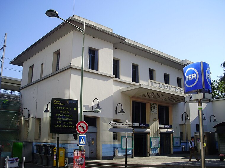
Photo: Geralix, CC BY-SA 3.0.
Laplace station is a station on the line B of the Réseau Express Régional, a hybrid suburban commuter and rapid transit line. It is located in the city of Arcueil. Laplace station is situated 770 metres east of Avenue et Fort de Montrouge.
Places in the Area
Nearby places include Arcueil and Montrouge.
Arcueil
Town

Photo: Damien94, Public domain.
Arcueil is a commune in the Val-de-Marne department in the southern suburbs of Paris, France. It is located 5.3 km from the center of Paris.
Montrouge
Town

Photo: Chabe01, CC BY-SA 4.0.
Montrouge is a commune in the southern Parisian suburbs, located 4.4 km from the centre of Paris. It is one of the most densely populated municipalities in Europe. After a long period of decline, the population has increased again in recent years.
Porte d’Orléans
Locality
The Porte d'Orléans is one of 17 portes in the Thiers wall, a defensive wall constructed in the mid-nineteenth century to protect Paris. The wall was demolished after the First World War, creating an open space that was subsequently built up.
Avenue et Fort de Montrouge
- Type: Bus stop
- Wheelchair access: yes
- Category: transportation
- Location: Arcueil, Arrondissement of L’Haÿ-les-Roses, Val-de-Marne, Île-de-France, France, Europe
- View on OpenStreetMap
Latitude
48.80962° or 48° 48′ 35″ northLongitude
2.32307° or 2° 19′ 23″ eastOpen location code
8FW4R85F+R6OpenStreetMap ID
node 2599969244OpenStreetMap feature
highway=bus_stopOpenStreetMap feature
public_transport=platformOpenStreetMap attribute
wheelchair=yesWikidata ID
Q56869519
This page is based on OpenStreetMap, Wikidata, and Wikimedia Commons.
We’d love your help improving our open data sources. Thank you for contributing.
Satellite Map
Discover Avenue et Fort de Montrouge from above in high-definition satellite imagery.
In Other Languages
“Avenue et Fort de Montrouge” goes by many names.
- French: “arrêt Avenue et Fort de Montrouge”
- French: “Arrêt Avenue et Fort de Montrouge”
- French: “Avenue Et Fort De Montrouge”
Notable Places Nearby
Highlights include Terrain n°13 and Terrain n°12.
Nearby Places
Explore places such as Avenue et Fort de Montrouge and Avenue et Fort de Montrouge.
Île-de-France: Must-Visit Destinations
Delve into Paris, Versailles, Boulogne-Billancourt, and Paris Charles de Gaulle Airport.
Curious Bus Stops to Discover
Uncover intriguing bus stops from every corner of the globe.
About Mapcarta. Data © OpenStreetMap contributors and available under the Open Database License". Text is available under the CC BY-SA 4.0 license, except for photos, directions, and the map. Photo: Guillaume Baviere, CC BY 2.0.