Ventilla
Ventilla is a railway stop in Madrid, Community of Madrid. Ventilla is situated nearby to the fire station Parque de Bomberos Nº4, as well as near the community center Centro Cultural Eduardo Úrculo.| Tap on a place to explore it |
Places of Interest Nearby
Highlights include Ventilla and plaza de Castilla.
Ventilla
Metro station
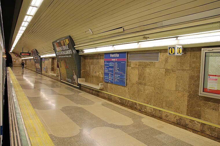
Photo: Draceane, CC BY-SA 4.0.
Ventilla is a station on Line 9 of the Madrid Metro, serving the Almenara barrio, commonly known as La Ventilla. It is located in fare Zone A.
plaza de Castilla
Square
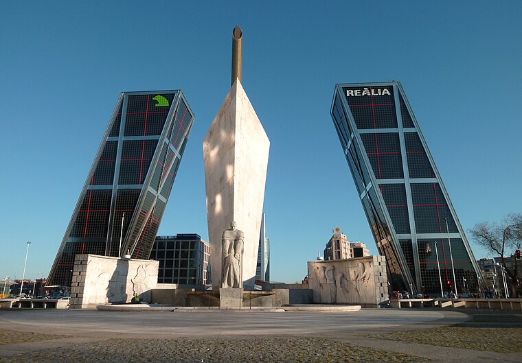
Photo: Zaqarbal, CC BY-SA 3.0.
The Plaza de Castilla is a square in the north of Madrid, Spain. plaza de Castilla is situated 720 metres southeast of Ventilla.
Hospital Carlos III
Hospital

Photo: Malopez 21, CC BY-SA 4.0.
The Hospital Carlos III is a public hospital in the city of Madrid. It belongs to the Servicio Madrileño de Salud, the health service of the Community of Madrid. Hospital Carlos III is situated 580 metres north of Ventilla.
Places in the Area
Nearby places include Almenara and Valdeacederas.
Almenara
Quarter
Photo: vpogarcia, CC BY-SA 2.0.
Almenara, also popularly known by the name of La Ventilla, is an administrative neighborhood of Madrid located in the district of Tetuán. It has an area of 0.999369 km2.
Valdeacederas
Quarter

Photo: Ricardo Ricote Rodríguez, CC BY 2.0.
Valdeacederas is an administrative neighborhood of Madrid belonging to the district of Tetuán.

Ventilla
- Type: Railway stop
- Categories: transport stop and transportation
- Location: Madrid, Madrid, Community of Madrid, Central Spain, Spain, Iberia, Europe
- View on OpenStreetMap
Latitude
40.46988° or 40° 28′ 12″ northLongitude
-3.69619° or 3° 41′ 46″ westOperator
Metro de MadridOpen location code
8CGRF893+XGOpenStreetMap ID
node 26203553OpenStreetMap feature
public_transport=stop_positionOpenStreetMap feature
railway=stop
This page is based on OpenStreetMap, Wikidata, and Wikimedia Commons.
We’d love your help improving our open data sources. Thank you for contributing.
Satellite Map
Discover Ventilla from above in high-definition satellite imagery.
Places with the Same Name
Discover other places named “Ventilla”.
Notable Places Nearby
Highlights include Parque de Bomberos Nº4 and Centro Cultural Eduardo Úrculo.
Nearby Places
Explore places such as Metro La Ventilla and Ventilla.
Madrid: Must-Visit Destinations
Delve into Sol-Letras-Lavapiés, Salamanca, Retiro-Paseo del Arte, and Chamberí-Castellana.
Curious Railway Stops to Discover
Uncover intriguing railway stops from every corner of the globe.
About Mapcarta. Data © OpenStreetMap contributors and available under the Open Database License". Text is available under the CC BY-SA 4.0 license, except for photos, directions, and the map. Photo: DonPaolo, CC BY-SA 3.0.