Siglo XXI
Siglo XXI is a transport stop in Boadilla del Monte, Madrid, Community of Madrid. Siglo XXI is situated nearby to the health club Electrobody center, as well as near the sports venue Oh fitness.| Tap on a place to explore it |
Places of Interest Nearby
Highlights include Siglo XXI and Infante Don Luis.
Siglo XXI
Railway station
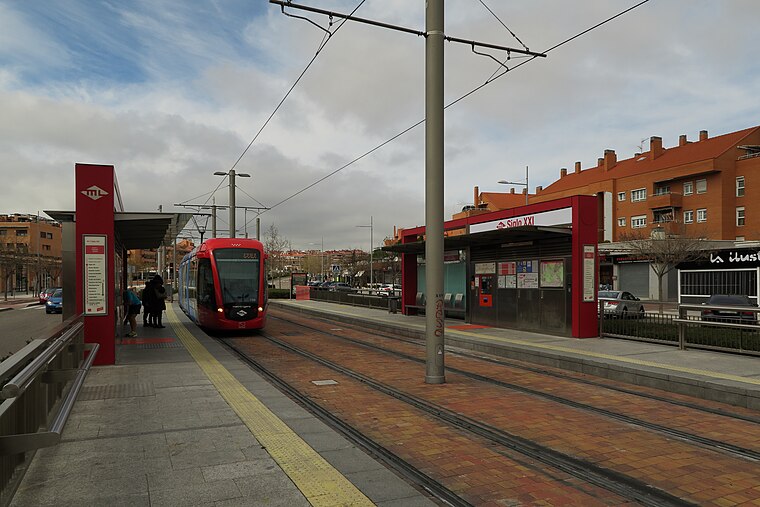
Photo: Malopez 21, CC BY-SA 4.0.
Siglo XXI is a station on Line 3 of the Metro Ligero. It is located in fare Zone B2.
Infante Don Luis
Railway station

Photo: Javitomad, Public domain.
Infante Don Luis is a station on Line 3 of the Metro Ligero. It is located in fare Zone B2. Infante Don Luis is situated 410 metres west of Siglo XXI.
Nuevo Mundo
Railway station

Photo: Zaqarbal, CC BY-SA 3.0.
Nuevo Mundo is a station on Line 3 of the Metro Ligero. It is located in fare Zone B2. Nuevo Mundo is situated 590 metres east of Siglo XXI.
Places in the Area
Nearby places include Romanillos and Villaviciosa de Odón.
Romanillos
Hamlet

Photo: Davidmesong, CC BY-SA 4.0.
Romanillos is a hamlet, which is situated 5 km northwest of Siglo XXI.
Villaviciosa de Odón
Town

Photo: Wikimedia, CC BY 3.0 es.
Villaviciosa de Odón is a municipality in the western zone of the Community of Madrid in Spain. The town is located 15 km west of Madrid's city center, in the western zone of the metro area. Villaviciosa de Odón is situated 5 km south of Siglo XXI.
Pozuelo de Alarcón
Town

Photo: Wikimedia, CC BY-SA 4.0.
Pozuelo de Alarcón is a municipality in the Community of Madrid, Spain. Bordering the Moncloa-Aravaca district of Madrid proper to its west, Pozuelo de Alarcón is surrounded by large Mediterranean pine-tree forests: the Casa de Campo, the Monte del Pardo, and the Monte del Pilar. Pozuelo de Alarcón is situated 7 km northeast of Siglo XXI.
Siglo XXI
- Type: Transport stop
- Category: transportation
- Location: Boadilla del Monte, Madrid, Community of Madrid, Central Spain, Spain, Iberia, Europe
- View on OpenStreetMap
Latitude
40.40514° or 40° 24′ 19″ northLongitude
-3.89265° or 3° 53′ 34″ westOpen location code
8CGRC444+3WOpenStreetMap ID
node 262627813OpenStreetMap feature
public_transport=stop_position
This page is based on OpenStreetMap, Wikidata, and Wikimedia Commons.
We’d love your help improving our open data sources. Thank you for contributing.
Satellite Map
Discover Siglo XXI from above in high-definition satellite imagery.
Places with the Same Name
Discover other places named “Siglo XXI”.
Notable Places Nearby
Highlights include Electrobody center and Oh fitness.
Nearby Places
Explore places such as Siglo XXI and Av. Siglo XXI - Est. Siglo XXI.
Community of Madrid: Must-Visit Destinations
Delve into Madrid, Alcalá de Henares, Getafe, and Aranjuez.
Curious Transport Stops to Discover
Uncover intriguing transport stops from every corner of the globe.
About Mapcarta. Data © OpenStreetMap contributors and available under the Open Database License". Text is available under the CC BY-SA 4.0 license, except for photos, directions, and the map. Photo: Wikimedia, CC0.