Moor Farm
Moor Farm is a farm in Dorrington, North Kesteven, England. Moor Farm is situated nearby to the forest Brauncewell Plantation, as well as near Bloxholm Gorse.| Tap on a place to explore it |
Places of Interest Nearby
Highlights include Church of St James and St John and Church of St Mary.
Church of St James and St John
Church

Photo: Colin Brammer, CC BY-SA 2.0.
Church of St James and St John is situated 1 mile northeast of Moor Farm.
Church of St Mary
Church

Photo: Richard Croft, CC BY-SA 2.0.
Church of St Mary is situated 1 mile north of Moor Farm.
Ruskington railway station
Railway station

Photo: Richard Croft, CC BY-SA 2.0.
Ruskington railway station serves the village of Ruskington in Lincolnshire, England. It opened in 1882 as part of the Great Northern and Great Eastern Joint Railway between Sleaford and Lincoln Central. Ruskington railway station is situated 1½ miles southeast of Moor Farm.
Places in the Area
Nearby places include Ruskington and Sleaford.
Ruskington
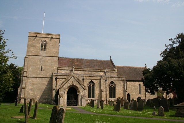
Photo: Richard Croft, CC BY-SA 2.0.
Ruskington is a large village in the North Kesteven district of Lincolnshire, England. The population was 5600 in 2011.
Sleaford

Photo: Dave Hitchborne, CC BY-SA 2.0.
Sleaford is a market town and civil parish in the North Kesteven district of Lincolnshire, England. On the edge of the Fenlands, it is 11 miles north-east of Grantham, 16 mi west of Boston, and 17 mi south of Lincoln.
Quarrington
Village

Photo: Dave Hitchborne, CC BY-SA 2.0.
Quarrington is a village and former civil parish, now part of the civil parish of Sleaford, in the North Kesteven district of Lincolnshire, England. The old village and its church lie approximately 1 miles south-west from the centre of Sleaford. Quarrington is situated 5 miles south of Moor Farm.
Moor Farm
- Type: Farm
- Categories: locality and agriculture
- Location: Dorrington, North Kesteven, Lincolnshire, East Midlands, England, United Kingdom, Britain and Ireland, Europe
- View on OpenStreetMap
Latitude
53.05646° or 53° 3′ 23″ northLongitude
-0.40566° or 0° 24′ 20″ westOpen location code
9C5X3H4V+HPOpenStreetMap ID
node 2663442562OpenStreetMap feature
place=farm
This page is based on OpenStreetMap, Wikidata, and Wikimedia Commons.
We’d love your help improving our open data sources. Thank you for contributing.
Satellite Map
Discover Moor Farm from above in high-definition satellite imagery.
Places with the Same Name
Discover other places named “Moor Farm”.
Notable Places Nearby
Highlights include Brauncewell Plantation and Bloxholm Gorse.
Nearby Places
Explore places such as Penneshaw Farm and Hartswood.
Lincolnshire: Must-Visit Destinations
Delve into Lincoln, Grimsby, Scunthorpe, and Stamford.
Curious Farms to Discover
Uncover intriguing farms from every corner of the globe.
About Mapcarta. Data © OpenStreetMap contributors and available under the Open Database License". Text is available under the CC BY-SA 4.0 license, except for photos, directions, and the map. Photo: Wikimedia, CC0.