New Hall Lane
New Hall Lane is a bus stop in Ruabon, Wrexham, Wales. New Hall Lane is situated nearby to Ruabon Post Office, as well as near the pitch Ruabon Crown Green Bowls Club.| Tap on a place to explore it |
Places of Interest Nearby
Highlights include Ruabon railway station and St Mary’s Church.
Ruabon railway station
Railway station

Photo: Ansbaradigeidfran, Public domain.
Ruabon railway station is a combined rail and bus interchange serving Ruabon, Wrexham County Borough, Wales. It is the second busiest station in Wrexham County Borough in terms of passenger journeys, after the mainline station, Wrexham General. Ruabon railway station is situated 1,800 feet southwest of New Hall Lane.
St Mary’s Church
Church
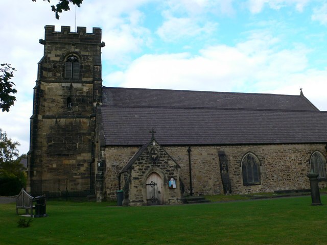
Photo: Eirian Evans, CC BY-SA 2.0.
St Mary's is a Grade I listed church in Ruabon, Wrexham County Borough, Wales. It is situated in the church yard between Bridge Street and Church Street. St Mary’s Church is situated 1,400 feet southwest of New Hall Lane.
Wynnstay Arms Hotel
Hotel

Photo: Maelor, Public domain.
The Wynnstay Arms is a hotel and public house in Ruabon, Wales. The Grade II listed building dates from the 18th-century and was a coaching inn. Meetings of the Football Association of Wales were held in the hotel in the 19th century shortly after the organisation was founded in the Wynnstay Arms Hotel, Wrexham. Wynnstay Arms Hotel is situated 1,400 feet south of New Hall Lane.
Places in the Area
Nearby places include Ruabon and Plas Madoc.
Ruabon
Village

Photo: Wikimedia, Public domain.
Ruabon is a village and community in Wrexham County Borough, Wales. The name comes from Rhiw Fabon, rhiw being the Welsh word for "slope" or "hillside" and Fabon being a mutation from St Mabon, the original church name, of earlier, Celtic origin.
Plas Madoc
Village
Plas Madoc is a housing estate and former electoral ward near Acrefair, in the Cefn community in Wrexham County Borough, Wales. It is located seven miles to the south-west of Wrexham, and contains The Land adventure playground, and a community-run leisure centre with a swimming pool.
Johnstown
Village

Photo: Peter Craine, CC BY-SA 2.0.
Johnstown is a village in Wrexham County Borough, Wales, and forms part of the historic coal mining community of Rhosllannerchrugog. It is thought to have been named after John Bury, a mid-19th century member of Wrexham's first Town Council, who built several houses in the area.
New Hall Lane
- Type: Bus stop
- Category: transportation
- Location: Ruabon, Wrexham, Wales, United Kingdom, Britain and Ireland, Europe
- View on OpenStreetMap
Latitude
52.99052° or 52° 59′ 26″ northLongitude
-3.03713° or 3° 2′ 14″ westOpen location code
9C4RXXR7+64OpenStreetMap ID
node 2667688613OpenStreetMap feature
highway=bus_stopOpenStreetMap feature
public_transport=platform
This page is based on OpenStreetMap, Wikidata, and Wikimedia Commons.
We’d love your help improving our open data sources. Thank you for contributing.
Satellite Map
Discover New Hall Lane from above in high-definition satellite imagery.
Places with the Same Name
Discover other places named “New Hall Lane”.
Notable Places Nearby
Highlights include Ruabon Post Office and Ruabon Crown Green Bowls Club.
Nearby Places
Explore places such as Bryntirion Terrace and Plas Tirion.
Wales: Must-Visit Destinations
Delve into Cardiff, Swansea, Newport, and Llanfairpwllgwyngyll.
Curious Bus Stops to Discover
Uncover intriguing bus stops from every corner of the globe.
About Mapcarta. Data © OpenStreetMap contributors and available under the Open Database License". Text is available under the CC BY-SA 4.0 license, except for photos, directions, and the map. Photo: Wikimedia, CC0.