Lodge Farm
Lodge Farm is a farm in West Deeping, South Kesteven District, England. Lodge Farm is situated nearby to the village Maxey, as well as near Deeping Gate.| Tap on a place to explore it |
Places of Interest Nearby
Highlights include Church of St Andrew and St Guthlac’s Church, Market Deeping.
Church of St Andrew
Church

Photo: Rex Needle, CC BY-SA 2.0.
Church of St Andrew is situated 1 mile south of Lodge Farm.
St Guthlac’s Church, Market Deeping
Church
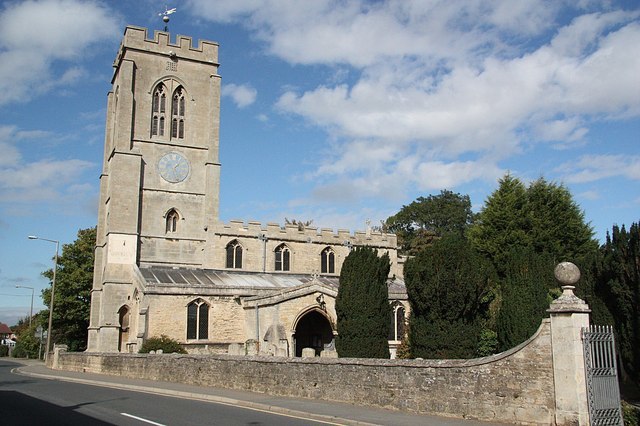
Photo: Richard Croft, CC BY-SA 2.0.
Saint Guthlac's Church, Market Deeping is a parish church of the Church of England in Market Deeping, Lincolnshire, England. St Guthlac’s Church, Market Deeping is situated 1½ miles east of Lodge Farm.
Church of St Peter
Church

Photo: Terry McKenna, CC BY-SA 2.0.
Church of St Peter is situated 1½ miles south of Lodge Farm.
Places in the Area
Nearby places include Maxey and Deeping Gate.
Maxey
Village

Photo: Rodney Burton, CC BY-SA 2.0.
Maxey is a village in the Peterborough unitary authority, in the ceremonial county of Cambridgeshire, England, located between Peterborough and Stamford and southwest of The Deepings.
Deeping Gate
Village

Photo: craig putterill, CC BY-SA 2.0.
Deeping Gate is a village and civil parish, lying on the River Welland in Cambridgeshire. Traditionally, the area was part of the Soke of Peterborough, geographically considered a part of Northamptonshire; it now falls within the City of Peterborough unitary authority area of Cambridgeshire. Deeping Gate is situated 2½ miles east of Lodge Farm.
Northborough
Village

Photo: Jay Haywood, CC BY-SA 2.0.
Northborough is a small village and civil parish in the Peterborough district, in the ceremonial county of Cambridgeshire, England. It has a pub, a shop, a school and a small castle. Northborough is situated 2½ miles southeast of Lodge Farm.
Lodge Farm
- Type: Farm
- Categories: locality and agriculture
- Location: West Deeping, South Kesteven District, Lincolnshire, East Midlands, England, United Kingdom, Britain and Ireland, Europe
- View on OpenStreetMap
Latitude
52.67782° or 52° 40′ 40″ northLongitude
-0.35378° or 0° 21′ 14″ westOpen location code
9C4XMJHW+4FOpenStreetMap ID
node 2699887882OpenStreetMap feature
place=farm
This page is based on OpenStreetMap, Wikidata, and Wikimedia Commons.
We’d love your help improving our open data sources. Thank you for contributing.
Satellite Map
Discover Lodge Farm from above in high-definition satellite imagery.
Places with the Same Name
Discover other places named “Lodge Farm”.
Notable Places Nearby
Highlights include Glebe Park and Black Bull Green.
Nearby Places
Explore places such as Rectory Farm and Crown Farm.
Lincolnshire: Must-Visit Destinations
Delve into Lincoln, Grimsby, Scunthorpe, and Stamford.
Curious Farms to Discover
Uncover intriguing farms from every corner of the globe.
About Mapcarta. Data © OpenStreetMap contributors and available under the Open Database License". Text is available under the CC BY-SA 4.0 license, except for photos, directions, and the map. Photo: Wikimedia, CC0.