Field Farm
Field Farm is a farm in Goxhill, North Lincolnshire, England. Field Farm is situated nearby to the forest Langmere Covert, as well as near the village Goxhill.| Tap on a place to explore it |
Places of Interest Nearby
Highlights include Goxhill railway station and All Saints Church, Goxhill.
Goxhill railway station
Railway station

Photo: David Wright, CC BY-SA 2.0.
Goxhill railway station serves the village of Goxhill in North Lincolnshire, England. It was built by the Great Grimsby and Sheffield Junction Railway in 1848. Goxhill railway station is situated 1½ miles west of Field Farm.
All Saints Church, Goxhill
Church
All Saints' Church is an Anglican church and Grade I Listed building in Goxhill, North Lincolnshire, England. All Saints Church, Goxhill is situated 1¼ miles west of Field Farm.
Thornton Abbey Gatehouse
City gate
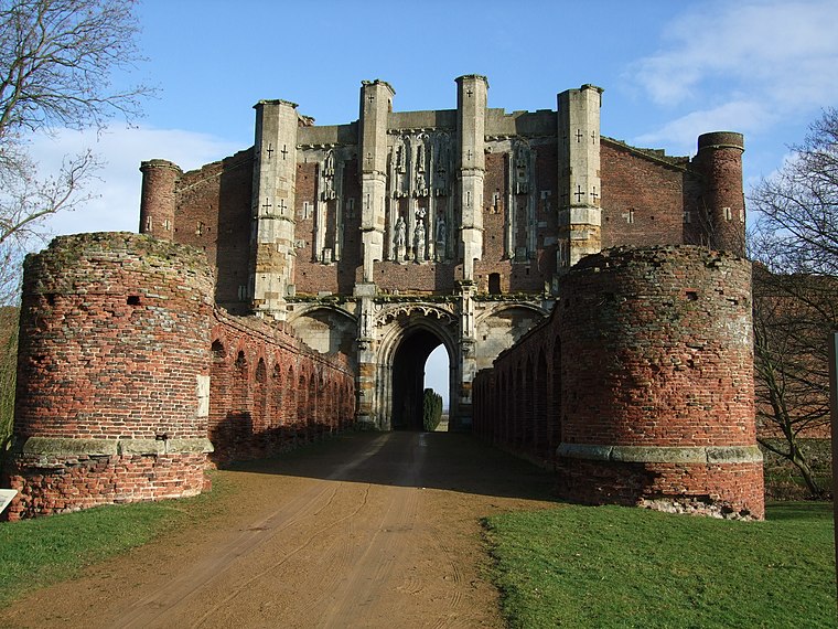
Photo: David Wright, CC BY 2.0.
Thornton Abbey Gatehouse is a city gate, which is situated 2 miles south of Field Farm.
Places in the Area
Nearby places include Goxhill and East Halton.
Goxhill
Village
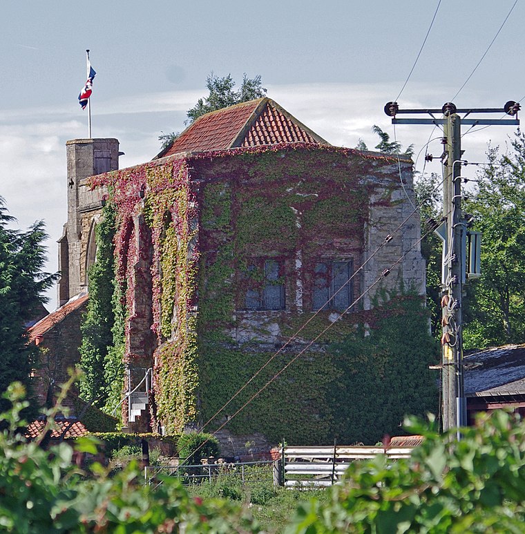
Photo: Wikimedia, CC BY-SA 2.0.
Goxhill is a village and civil parish in North Lincolnshire, England. The population of the civil parish taken at the 2011 census was 2,290. It is situated 5 miles east from Barton-upon-Humber and 10 miles north-west from Immingham.
East Halton
Village
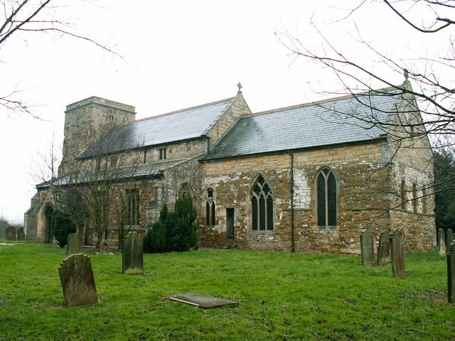
Photo: Keith Havercroft, CC BY-SA 2.0.
East Halton is a small village and civil parish in North Lincolnshire, England. It is situated close to the Humber estuary, approximately 4 miles north-west from Immingham and 1 mile north from the neighbouring village of North Killingholme. East Halton is situated 1½ miles southeast of Field Farm.
Barrow Hann
Locality
Barrow Hann is a village in North Lincolnshire, England. It is in the civil parish of Barrow upon Humber. Barrow Hann is situated 3 miles west of Field Farm.
Field Farm
- Type: Farm
- Categories: locality and agriculture
- Location: Goxhill, North Lincolnshire, England, United Kingdom, Britain and Ireland, Europe
- View on OpenStreetMap
Latitude
53.68113° or 53° 40′ 52″ northLongitude
-0.30219° or 0° 18′ 8″ westOpen location code
9C5XMMJX+F4OpenStreetMap ID
node 2702393024OpenStreetMap feature
place=farm
This page is based on OpenStreetMap, Wikidata, and Wikimedia Commons.
We’d love your help improving our open data sources. Thank you for contributing.
Satellite Map
Discover Field Farm from above in high-definition satellite imagery.
Places with the Same Name
Discover other places named “Field Farm”.
Notable Places Nearby
Highlights include Langmere Covert and Goxhill Primary School.
Nearby Places
Explore places such as Langmere Lodge and Field House.
England: Must-Visit Destinations
Delve into London, Manchester, Sheffield, and Leeds.
Curious Farms to Discover
Uncover intriguing farms from every corner of the globe.
About Mapcarta. Data © OpenStreetMap contributors and available under the Open Database License". Text is available under the CC BY-SA 4.0 license, except for photos, directions, and the map. Photo: sidibousaid, CC BY 2.0.