Roman camp
Roman camp is an archaeological site in Iwerne Stepleton, North Dorset District, England. Roman camp is situated nearby to the peak Hod Hill, as well as near Hanford School.| Tap on a place to explore it |
Places of Interest Nearby
Highlights include Hod Hill and Hanford School.
Hod Hill
Protected area

Photo: Jim Champion, CC BY-SA 2.0.
Hod Hill is a large hill fort in the Blackmore Vale, 3 miles north-west of Blandford Forum, Dorset, England. The fort sits on a 143 m chalk hill of the same name that lies between the adjacent Dorset Downs and Cranborne Chase. Hod Hill is situated 830 feet southeast of Roman camp.
Hanford School
School

Photo: Chris Downer, CC BY-SA 2.0.
Hanford School is a girls' boarding preparatory school located in Hanford, Child Okeford, Dorset, England, established in 1947 and located in a grade II* listed house built in 1604 by Sir Robert Seymer. Hanford School is situated 3,100 feet west of Roman camp.
Church of the Holy Trinity
Church

Photo: Chris Downer, CC BY-SA 2.0.
Church of the Holy Trinity is situated 1 mile south of Roman camp.
Places in the Area
Nearby places include Iwerne Courtney and Child Okeford.
Iwerne Courtney
Village

Photo: David Squire, CC BY-SA 2.0.
Iwerne Courtney, also known as Shroton, is a village and civil parish in the English county of Dorset. It lies approximately 4 miles north-west of Blandford Forum.
Child Okeford
Village

Photo: Clive Perrin, CC BY-SA 2.0.
Child Okeford is a village and civil parish in the county of Dorset in southern England, 3 miles east of the small town of Sturminster Newton. Child Okeford lies downstream from Sturminster, along the River Stour, which passes half a mile west of the village. Child Okeford is situated 1½ miles northwest of Roman camp.
Iwerne Minster
Village
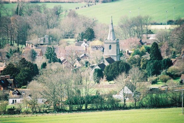
Photo: Chris Downer, CC BY-SA 2.0.
Iwerne Minster is a village and civil parish in Dorset, England. It lies on the edge of the Blackmore Vale, approximately midway between the towns of Shaftesbury and Blandford Forum. Iwerne Minster is situated 2½ miles north of Roman camp.
Roman camp
- Type: Archaeological site
- Categories: historic site, tourist attraction, and tourism
- Location: Iwerne Stepleton, North Dorset District, Dorset, West Country, England, United Kingdom, Britain and Ireland, Europe
- View on OpenStreetMap
Latitude
50.89636° or 50° 53′ 47″ northLongitude
-2.2079° or 2° 12′ 28″ westOpen location code
9C2VVQWR+GROpenStreetMap ID
node 2753139304OpenStreetMap feature
historic=archaeological_site
This page is based on OpenStreetMap, Wikidata, and Wikimedia Commons.
We’d love your help improving our open data sources. Thank you for contributing.
Satellite Map
Discover Roman camp from above in high-definition satellite imagery.
Places with the Same Name
Discover other places named “Roman camp”.
Notable Places Nearby
Highlights include Hod Hill and Stepleton House.
Nearby Places
Explore places such as Stourpaine Sewage Works and Hanford Farm.
Dorset: Must-Visit Destinations
Delve into Bournemouth, Poole, Dorchester, and Weymouth.
Curious Archaeological Sites to Discover
Uncover intriguing archaeological sites from every corner of the globe.
About Mapcarta. Data © OpenStreetMap contributors and available under the Open Database License". Text is available under the CC BY-SA 4.0 license, except for photos, directions, and the map. Photo: Diliff, CC BY-SA 3.0.