Interfaith Food Cupboard
Interfaith Food Cupboard is a social service facility in Philadelphia, Philadelphia Region, Pennsylvania which is located on Baring Street. Interfaith Food Cupboard is situated nearby to Church of Saint Andrew and Saint Monica, as well as near Metropolitian Baptist Church.| Tap on a place to explore it |
- Opening hours: Saturday 9:30 AM—11:00 AM
- Type: Social service facility
- Address: 3600 Baring Street, Philadelphia, 19104
Places of Interest Nearby
Highlights include Philadelphia Art Museum and Presby.
Philadelphia Art Museum
Museum
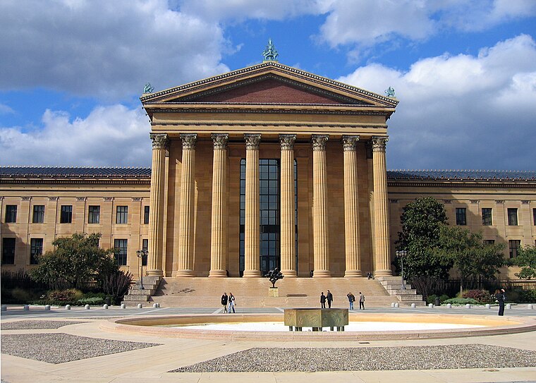
Photo: Wikimedia, Public domain.
The Philadelphia Art Museum, formerly the Philadelphia Museum of Art, is an art museum originally chartered in 1876 for the Centennial Exposition in Philadelphia. Philadelphia Art Museum is situated 4,100 feet northeast of Interfaith Food Cupboard.
Presby
Hospital
Penn Presbyterian Medical Center, sometimes called Presby, is a hospital located in the University City section of West Philadelphia. It was founded by Reverend Ephraim D. Presby is situated 1,700 feet southwest of Interfaith Food Cupboard.
30th Street Station
Railway station

Photo: Smallbones, Public domain.
30th Street Station, officially William H. Gray III 30th Street Station, is a major intermodal transit station in Philadelphia, Pennsylvania, United States. 30th Street Station is situated 3,900 feet southeast of Interfaith Food Cupboard.
Places in the Area
Nearby places include Mantua and Powelton Village.
Mantua
Neighborhood

Photo: Roesluna, CC BY-SA 3.0.
Mantua is a neighborhood in the West Philadelphia section of Philadelphia, Pennsylvania. It is located north of Spring Garden Street, east of 40th Street, south of Mantua Avenue, and west of 31st Street.
Powelton Village
Neighborhood

Photo: MikeJones133, Public domain.
Powelton Village is a neighborhood in the West Philadelphia section of Philadelphia, Pennsylvania. It consists of mostly Victorian and twin style homes.
Belmont District
Neighborhood

Photo: Smallbones, Public domain.
Belmont District was a district that existed briefly in Philadelphia County, Pennsylvania, United States. The district was created on April 14, 1853 from northern Blockley Township ceased to exist and on February 2, 1854 the district was incorporated into the City of Philadelphia following the passage of the Act of Consolidation, 1854.
Interfaith Food Cupboard
Latitude
39.96099° or 39° 57′ 40″ northLongitude
-75.19424° or 75° 11′ 39″ westOpen location code
87F6XR64+98OpenStreetMap ID
node 2767171632OpenStreetMap feature
amenity=social_facility
This page is based on OpenStreetMap, Wikidata, and Wikimedia Commons.
We’d love your help improving our open data sources. Thank you for contributing.
Satellite Map
Discover Interfaith Food Cupboard from above in high-definition satellite imagery.
Notable Places Nearby
Highlights include Church of Saint Andrew and Saint Monica and Metropolitian Baptist Church.
Nearby Places
Explore places such as 36th & Baring and Powel Elementary School.
Philadelphia: Must-Visit Destinations
Delve into Philadelphia International Airport, Old City, West Philadelphia, and Center City West.
Curious Social Service Facilities to Discover
Uncover intriguing social service facilities from every corner of the globe.
About Mapcarta. Data © OpenStreetMap contributors and available under the Open Database License". Text is available under the CC BY-SA 4.0 license, except for photos, directions, and the map. Photo: Dave Z, CC BY 2.0.