U2
U2 is a bunker in Bruckneudorf, Neusiedl am See District, Burgenland. U2 is situated nearby to the historic building ehemalige Wach- und Bauhütte, as well as near the museum Bunkeranlage Ungerberg.| Tap on a place to explore it |
Places of Interest Nearby
Highlights include Bunkeranlage Ungerberg and Schloß Prugg.
Bunkeranlage Ungerberg
Museum

Photo: Pappenheim, Copyrighted free use.
Bunkeranlage Ungerberg is a museum.
Schloß Prugg
Castle

Photo: Bwag, CC BY-SA 4.0.
Schloß Prugg is a castle, which is situated 2½ km northwest of U2.
Bruck an der Leitha railway station
Railway station

Photo: Priwo, Public domain.
Bruck an der Leitha railway station is situated 2½ km west of U2.
Places in the Area
Nearby places include Jois and Höflein.
Jois
Village
 Jois is a small town in the district of Neusiedl am See in Burgenland in Eastern Austria. It is on the northern shore of Lake Neusiedl, which straddles the border with Hungary. Jois is situated 6 km south of U2.
Höflein
Village
Höflein is a town in the district of Bruck an der Leitha in Lower Austria in Austria. Höflein is situated 7 km north of U2.
Rohrau
Village
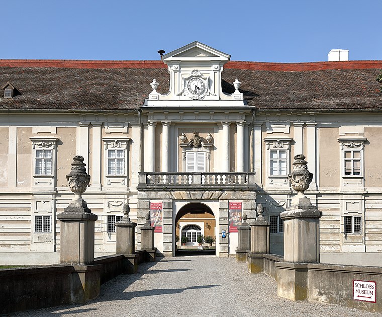
Photo: Bwag, CC BY-SA 4.0.
Rohrau is a village in the state of Lower Austria. The name comes from two German words: Rohr and Au. South of the village is a riparian forest and a swamp covered with reed. Rohrau is situated 7 km northeast of U2.
U2
- Type: Bunker
- Category: historic site
- Location: Bruckneudorf, Neusiedl am See District, Burgenland, Austria, Central Europe, Europe
- View on OpenStreetMap
Latitude
48.01272° or 48° 0′ 46″ northLongitude
16.81419° or 16° 48′ 51″ eastOpen location code
8FWR2R77+3MOpenStreetMap ID
node 2772906023OpenStreetMap feature
historic=bunker
This page is based on OpenStreetMap, Wikidata, and Wikimedia Commons.
We’d love your help improving our open data sources. Thank you for contributing.
Satellite Map
Discover U2 from above in high-definition satellite imagery.
Notable Places Nearby
Highlights include ehemalige Wach- und Bauhütte and Gorgoschillizkapelle.
Nearby Places
Explore places such as U38 and Die 85mm Panzerabwehrkannone 52/55.
Burgenland: Must-Visit Destinations
Delve into Eisenstadt, Neusiedl am See, Rust, and Güssing.
Curious Bunkers to Discover
Uncover intriguing bunkers from every corner of the globe.
About Mapcarta. Data © OpenStreetMap contributors and available under the Open Database License". Text is available under the CC BY-SA 4.0 license, except for photos, directions, and the map. Photo: Wikimedia, CC BY-SA 4.0.