Tulip Gakuen
Tulip Gakuen is a school in Amstelveen, Amstelland, North Holland which is located on Amsterdamseweg. Tulip Gakuen is situated nearby to the sports venue Sporting Martinus, as well as near Sportpark Overburg.| Tap on a place to explore it |
Places of Interest Nearby
Highlights include Jac. P. Thijssepark and De Braak.
Jac. P. Thijssepark
Park
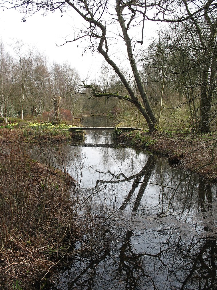
Photo: Esther Westerveld, CC BY 2.0.
Jac. P. Thijssepark is situated 300 metres northwest of Tulip Gakuen.
De Braak
Park

Photo: Ceescamel, CC BY-SA 4.0.
De Braak is a park, which is situated 400 metres northeast of Tulip Gakuen.
Cobra Museum
Museum

Photo: Wikimedia, CC BY-SA 2.5.
The Cobra Museum of Modern Art is an art museum in Amstelveen in the Netherlands. The collection of the museum consists of key works by artists associated with three art movements, Vrij Beelden, Cobra, and Creatie. Cobra Museum is situated 1¼ km southeast of Tulip Gakuen.
Places in the Area
Nearby places include Bovenkerk and Nieuwe Meer.
Bovenkerk
Neighborhood
Bovenkerk is a village in the municipality of Amstelveen in the province of North Holland, Netherlands. Bovenkerk was part of the municipality of Nieuwer-Amstel until 1964, when it was absorbed in the newly-formed municipality of Amstelveen.
Nieuwe Meer
Neighborhood

Photo: SimonSays, CC BY 2.5 nl.
Nieuwe Meer is a hamlet in the Dutch province of North Holland. It is a part of the municipality of Haarlemmermeer, and lies about 8 km southwest of Amsterdam.
Gershwin
Neighborhood

Photo: Rokus Cornelis, CC BY 3.0.
Gershwin is a neighborhood, which is situated 3½ km northeast of Tulip Gakuen.
Tulip Gakuen
- Type: School
- Address: Amsterdamseweg 209, Amstelveen, 1182GW
- Category: education
- Location: Amstelveen, Amstelland, North Holland, Western Netherlands, Netherlands, Benelux, Europe
- View on OpenStreetMap
Latitude
52.31216° or 52° 18′ 44″ northLongitude
4.84637° or 4° 50′ 47″ eastOperator
Stichting Japanse Kleuter SchoolOpen location code
9F468R6W+VGOpenStreetMap ID
node 2783661366OpenStreetMap feature
amenity=school
This page is based on OpenStreetMap, Wikidata, and Wikimedia Commons.
We’d love your help improving our open data sources. Thank you for contributing.
Satellite Map
Discover Tulip Gakuen from above in high-definition satellite imagery.
Notable Places Nearby
Highlights include Sporting Martinus and Sportpark Overburg.
Nearby Places
Explore places such as Startpunt Heemparken and Amstelveen, Oude Karselaan.
Amstelland: Must-Visit Destinations
Delve into Amsterdam, Schiphol Airport, Binnenstad, and Aalsmeer.
Curious Schools to Discover
Uncover intriguing schools from every corner of the globe.
About Mapcarta. Data © OpenStreetMap contributors and available under the Open Database License". Text is available under the CC BY-SA 4.0 license, except for photos, directions, and the map. Photo: Ilonamay, CC BY-SA 3.0.