Rowston
Rowston is a level crossing in Rowston, North Kesteven, England. Rowston is situated nearby to Church of St Clement, as well as near the forest Marshall Hill Plantation.| Tap on a place to explore it |
Places of Interest Nearby
Highlights include Church of St Clement and Church of the Holy Cross.
Church of St Clement
Church

Photo: Richard Croft, CC BY-SA 2.0.
Church of St Clement is situated 1,300 feet west of Rowston.
Church of the Holy Cross
Church

Photo: roger geach, CC BY-SA 2.0.
Church of the Holy Cross is situated 1 mile north of Rowston.
North Ings Farm Museum
Museum

Photo: Chris, CC BY-SA 2.0.
The North Ings Farm Museum is a working farm museum containing a 2 ft narrow gauge railway, running on a circuit of 1⁄4 mile. It is located at Dorrington, between Lincoln and Sleaford, in Lincolnshire. North Ings Farm Museum is situated 2½ miles south of Rowston.
Places in the Area
Nearby places include Ruskington and Metheringham.
Ruskington
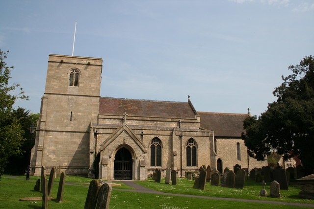
Photo: Richard Croft, CC BY-SA 2.0.
Ruskington is a large village in the North Kesteven district of Lincolnshire, England. The population was 5600 in 2011.
Metheringham
Village

Photo: Dave Hitchborne, CC BY-SA 2.0.
Metheringham is a village and civil parish in the North Kesteven district of Lincolnshire, England. The population of the civil parish at the 2011 census was 3,605. Metheringham is situated 3½ miles north of Rowston.
Billinghay
Village

Photo: Andrew Hill, CC BY-SA 2.0.
Billinghay is a village and civil parish in the North Kesteven district of Lincolnshire, England. The village is situated approximately 7 miles north-east from Sleaford, and lies on the B1189 Walcott road near its junction with the A153. Billinghay is situated 4 miles east of Rowston.
Rowston
- Type: Level crossing
- Category: transportation
- Location: Rowston, North Kesteven, Lincolnshire, East Midlands, England, United Kingdom, Britain and Ireland, Europe
- View on OpenStreetMap
Latitude
53.09297° or 53° 5′ 35″ northLongitude
-0.37691° or 0° 22′ 37″ westOpen location code
9C5X3JVF+56OpenStreetMap ID
node 2785030907OpenStreetMap feature
railway=level_crossing
This page is based on OpenStreetMap, Wikidata, and Wikimedia Commons.
We’d love your help improving our open data sources. Thank you for contributing.
Satellite Map
Discover Rowston from above in high-definition satellite imagery.
Places with the Same Name
Discover other places named “Rowston”.
Notable Places Nearby
Highlights include Marshall Hill Plantation and Digby Corner.
Nearby Places
Explore places such as Rowston and Manor Farm.
Lincolnshire: Must-Visit Destinations
Delve into Lincoln, Grimsby, Scunthorpe, and Stamford.
Curious Level Crossings to Discover
Uncover intriguing level crossings from every corner of the globe.
About Mapcarta. Data © OpenStreetMap contributors and available under the Open Database License". Text is available under the CC BY-SA 4.0 license, except for photos, directions, and the map. Photo: Wikimedia, CC0.