Wollstraße
Wollstraße is a tram stop in Rhineland-Palatinate, Germany. Wollstraße is situated nearby to the mosque Mevlana Camii DITIB, as well as near the hospital Berufsgenossenschaftliche Unfallklinik Ludwigshafen.| Tap on a place to explore it |
Places of Interest Nearby
Highlights include Ludwigshafen-Oggersheim station and Friedhof Friesenheim.
Ludwigshafen-Oggersheim station
Railway station
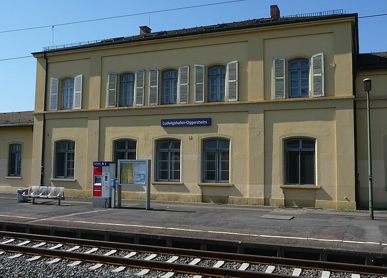
Photo: Immanuel Giel, Public domain.
Ludwigshafen-Oggersheim station is a railway station, which is situated 1½ km northwest of Wollstraße.
Friedhof Friesenheim
Cemetery

Photo: Immanuel Giel, CC BY-SA 3.0.
Friedhof Friesenheim is a cemetery, which is situated 1 km northeast of Wollstraße.
Friedrich-Ebert-Halle
Sports venue

Photo: Immanuel Giel, CC BY-SA 3.0.
Friedrich-Ebert-Halle is an indoor arena located in Ludwigshafen, Germany, which can accommodate 2,250 guests. The facility was designed by Roland Rainer and completed in 1965. Friedrich-Ebert-Halle is situated 1¼ km northeast of Wollstraße.
Places in the Area
Nearby places include Hemshof and Ludwigshafen.
Hemshof
Suburb
Hemshof is one of the oldest city districts of Ludwigshafen Am Rhein, Germany. It is located above the "Nord" district. The first settlement in Hemshof is believed to have been built by the Celts in 516, not as a city but as a small farm. Hemshof is situated 2½ km east of Wollstraße.
Ludwigshafen

Photo: Engelberger, CC BY-SA 3.0.
Ludwigshafen, officially Ludwigshafen am Rhein, is a city in the German state of Rhineland-Palatinate, on the river Rhine, opposite Mannheim. With Mannheim, Heidelberg, and the surrounding region, it forms the Rhine-Neckar Metropolitan Region.
Mundenheim
Suburb

Photo: Immanuel Giel, Public domain.
Mundenheim is a suburb, which is situated 3½ km southeast of Wollstraße.
Wollstraße
- Type: Tram stop
- Wheelchair access: yes
- Category: transportation
- Location: Rhineland-Palatinate, Germany, Central Europe, Europe
- View on OpenStreetMap
Latitude
49.48562° or 49° 29′ 8″ northLongitude
8.39736° or 8° 23′ 51″ eastOpen location code
8FXCF9PW+6WOpenStreetMap ID
node 278711209OpenStreetMap feature
railway=tram_stopOpenStreetMap attribute
wheelchair=yes
This page is based on OpenStreetMap, Wikidata, and Wikimedia Commons.
We’d love your help improving our open data sources. Thank you for contributing.
Satellite Map
Discover Wollstraße from above in high-definition satellite imagery.
Notable Places Nearby
Highlights include Mevlana Camii DITIB and Berufsgenossenschaftliche Unfallklinik Ludwigshafen.
Nearby Places
Explore places such as Wollstraße and Renck-Weindel.
Rhineland-Palatinate: Must-Visit Destinations
Delve into Mainz, Trier, Koblenz, and Worms.
Curious Tram Stops to Discover
Uncover intriguing tram stops from every corner of the globe.
About Mapcarta. Data © OpenStreetMap contributors and available under the Open Database License". Text is available under the CC BY-SA 4.0 license, except for photos, directions, and the map. Photo: Traveler100, CC BY-SA 3.0.