Gemeentehuis Dantumadiel
Gemeentehuis Dantumadiel is a town hall in Dantumadiel Municipality, Friesland which is located on Hynsteblom. Gemeentehuis Dantumadiel is situated nearby to the playground De Korenbloem, as well as near the church Hervormde kerk.| Tap on a place to explore it |
- Email: info@dantumadiel.frl
- Type: Town hall
- Address: Hynsteblom 4, Damwâld, 9104BR
Places of Interest Nearby
Highlights include De Mearmin and Grutte Mûne, Broeksterwâld.
De Mearmin
Windmill

Photo: RomkeHoekstra, CC BY-SA 4.0.
De Mearmin, formerly also known as Geestermermeermolen, is a smock mill in Damwâld, Friesland, Netherlands, which was built in 1968 at Dokkum. The mill is listed as a Rijksmonument, number 467708. De Mearmin is situated 1¼ km east of Gemeentehuis Dantumadiel.
Grutte Mûne, Broeksterwâld
Windmill

Photo: Theun, CC BY-SA 3.0.
The Grutte Mûne is a smock mill in Broeksterwâld, Friesland, Netherlands which has been restored to working order. The mill is listed as a Rijksmonument, number 11679. Grutte Mûne, Broeksterwâld is situated 2 km southwest of Gemeentehuis Dantumadiel.
Museum Dokkum
Museum

Photo: Gouwenaar, Public domain.
Museum Dokkum is situated 4 km north of Gemeentehuis Dantumadiel.
Places in the Area
Nearby places include Damwâld and Broeksterwâld.
Damwâld
Village

Photo: Baykedevries, CC BY-SA 3.0 nl.
Damwâld is a village in the Dantumadiel municipality of Friesland, in the Netherlands. In 2020 it had 5630 citizens. This number of citizens makes Damwâld the largest village in the municipality of Dantumadiel.
Broeksterwâld
Village
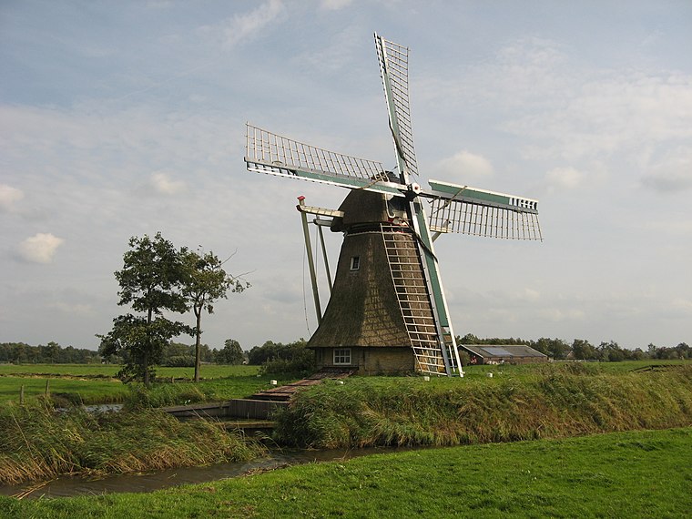
Photo: Reboelje, Public domain.
Broeksterwâld is a village in the Dantumadiel municipality of Friesland, in the Netherlands. In 2017, it had a population of around 1,100.
Wâlterswâld
Village

Photo: Wikimedia, CC BY-SA 4.0.
Wâlterswâld is a village in Dantumadiel municipality, Friesland, the Netherlands. The village had a population of approximately 920 in 2017. The village as two residential centers, a northern and southern center.
Gemeentehuis Dantumadiel
- Category: government building
- Location: Dantumadiel Municipality, Friesland, Northern Netherlands, Netherlands, Benelux, Europe
- View on OpenStreetMap
Latitude
53.29102° or 53° 17′ 28″ northLongitude
5.99505° or 5° 59′ 42″ eastOperator
Gemeente DantumadielOpen location code
9F577XRW+C2OpenStreetMap ID
node 2800494902OpenStreetMap feature
amenity=townhall
This page is based on OpenStreetMap, Wikidata, and Wikimedia Commons.
We’d love your help improving our open data sources. Thank you for contributing.
Satellite Map
Discover Gemeentehuis Dantumadiel from above in high-definition satellite imagery.
Notable Places Nearby
Highlights include De Korenbloem and Hervormde kerk.
Nearby Places
Explore places such as Mûnewei and De Kruisweg.
Friesland: Must-Visit Destinations
Delve into Leeuwarden, Heerenveen, Sneek, and Harlingen.
Curious Town Halls to Discover
Uncover intriguing town halls from every corner of the globe.
About Mapcarta. Data © OpenStreetMap contributors and available under the Open Database License". Text is available under the CC BY-SA 4.0 license, except for photos, directions, and the map. Photo: WiDi, CC BY-SA 3.0.