Common Farm
Common Farm is a farm in West Butterwick, North Lincolnshire, England. Common Farm is situated nearby to the village Beltoft, as well as near the forest Moonfield Thick.| Tap on a place to explore it |
Places of Interest Nearby
Highlights include Church of St Mary and Old Rectory, Epworth.
Church of St Mary
Church

Photo: Dave Hitchborne, CC BY-SA 2.0.
Church of St Mary is situated 1¼ miles east of Common Farm.
Old Rectory, Epworth
Museum

Photo: Peter Church, CC BY-SA 2.0.
The Old Rectory in Epworth, Lincolnshire is a Queen Anne-style building, rebuilt in 1709, which has been restored and is now the property of the Methodist Church of Great Britain, who maintain it as a museum. Old Rectory, Epworth is situated 2 miles southwest of Common Farm.
Church of St Andrew
Church
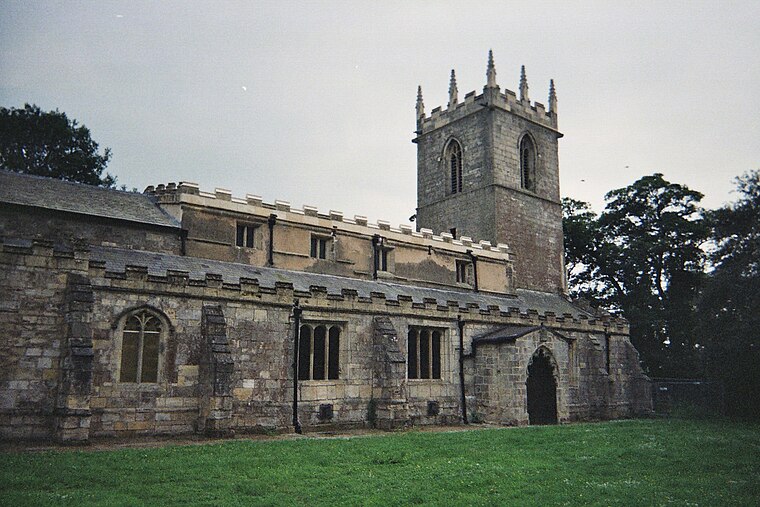
Photo: Asterion, CC BY-SA 2.5.
Church of St Andrew is situated 2 miles west of Common Farm.
Places in the Area
Nearby places include Beltoft and West Butterwick.
Beltoft
Village
Beltoft is a hamlet in the civil parish of Belton, North Lincolnshire, England. The village lies within the Isle of Axholme and is 4 miles south-east of Crowle.
West Butterwick
Village
Photo: Dave Hitchborne, CC BY-SA 2.0.
West Butterwick is a village and civil parish in North Lincolnshire, England. It lies in the Isle of Axholme, approximately 4 miles north-east from Epworth and 4 miles north from Owston Ferry, on the western bank of the River Trent opposite its neighbour East Butterwick.
East Butterwick
Village

Photo: Richard Croft, CC BY-SA 2.0.
East Butterwick is a village and civil parish in North Lincolnshire, England. It lies in the Isle of Axholme, about 4 miles north-east from Epworth and 4 miles north from Owston Ferry, on the eastern bank of the River Trent opposite its neighbour West Butterwick. East Butterwick is situated 1½ miles east of Common Farm.
Common Farm
- Type: Farm
- Categories: locality and agriculture
- Location: West Butterwick, North Lincolnshire, England, United Kingdom, Britain and Ireland, Europe
- View on OpenStreetMap
Latitude
53.53787° or 53° 32′ 16″ northLongitude
-0.77255° or 0° 46′ 21″ westOpen location code
9C5XG6QG+4XOpenStreetMap ID
node 2914396401OpenStreetMap feature
place=farm
This page is based on OpenStreetMap, Wikidata, and Wikimedia Commons.
We’d love your help improving our open data sources. Thank you for contributing.
Satellite Map
Discover Common Farm from above in high-definition satellite imagery.
Places with the Same Name
Discover other places named “Common Farm”.
Notable Places Nearby
Highlights include Epworth Fields Holiday Park and Fred Woofit Memorial Hall.
Nearby Places
Explore places such as Butterwick Grange and Glebe Farm.
England: Must-Visit Destinations
Delve into London, Manchester, Sheffield, and Leeds.
Curious Farms to Discover
Uncover intriguing farms from every corner of the globe.
About Mapcarta. Data © OpenStreetMap contributors and available under the Open Database License". Text is available under the CC BY-SA 4.0 license, except for photos, directions, and the map. Photo: sidibousaid, CC BY 2.0.