Walker St opp Timbrol Av
Walker St opp Timbrol Av is a bus stop in City of Canada Bay, New South Wales. Walker St opp Timbrol Av is situated nearby to Phoenix Park, as well as near Rhodes Community Garden.| Tap on a place to explore it |
Places of Interest Nearby
Highlights include Rhodes railway station and Rhodes Waterside.
Rhodes railway station
Railway station
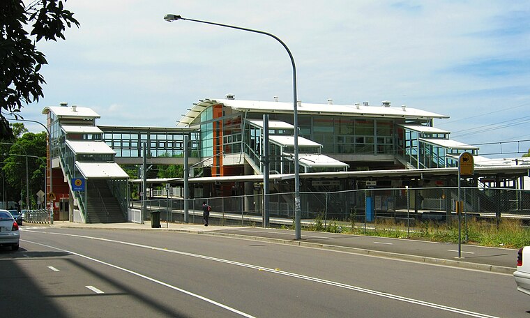
Photo: Shy Guy Gunzel, CC BY-SA 3.0.
Rhodes railway station is a heritage-listed suburban railway station located on the Main North line, serving the Sydney suburb of Rhodes. It is served by Sydney Trains T9 Northern Line services. Rhodes railway station is situated 370 metres south of Walker St opp Timbrol Av.
Rhodes Waterside
Shopping center

Photo: Mfunnell, CC BY-SA 3.0.
Rhodes Waterside is a shopping centre in the suburb of Rhodes in the Inner West of Sydney, Australia. Rhodes Waterside is situated 1 km south of Walker St opp Timbrol Av.
John Whitton Bridge
Bridge
 The John Whitton Bridge is a railway bridge that carries the Main Northern railway line across the Parramatta River, located between the Sydney suburbs of Rhodes and Meadowbank. John Whitton Bridge is situated 590 metres north of Walker St opp Timbrol Av.
Places in the Area
Nearby places include Liberty Grove and Melrose Park.
Liberty Grove
Suburb

Photo: Stephen.frede, Public domain.
Liberty Grove is a suburb in the Inner West of Sydney, in the state of New South Wales, Australia. Liberty Grove is located 17 kilometres west of the Sydney central business district, in the local government area of the City of Canada Bay.
Melrose Park
Suburb
 Melrose Park is a suburb of Sydney, New South Wales, Australia, located 12 kilometres north-west of the Sydney central business district. Melrose Park is split between the local government areas of the City of Ryde and the City of Parramatta.
West Ryde
Suburb

Photo: John Dalton, CC BY-SA 3.0.
West Ryde is a suburb of Sydney, in the state of New South Wales, Australia. West Ryde is located 16 kilometres north-west of the Sydney central business district, in the local government area of the City of Ryde and is part of the Northern Sydney region. Ryde, North Ryde and East Ryde are separate suburbs.
Walker St opp Timbrol Av
- Type: Bus stop
- Wheelchair access: yes
- Category: transportation
- Location: City of Canada Bay, New South Wales, Australia, Oceania
- View on OpenStreetMap
Latitude
-33.82709° or 33° 49′ 38″ southLongitude
151.08757° or 151° 5′ 15″ eastNetwork
Buses in SydneyOpen location code
4RRH53FQ+52OpenStreetMap ID
node 2924574772OpenStreetMap feature
highway=bus_stopOpenStreetMap feature
public_transport=platformOpenStreetMap attribute
wheelchair=yes
This page is based on OpenStreetMap, Wikidata, and Wikimedia Commons.
We’d love your help improving our open data sources. Thank you for contributing.
Satellite Map
Discover Walker St opp Timbrol Av from above in high-definition satellite imagery.
Notable Places Nearby
Highlights include Phoenix Park and Rhodes Community Garden.
Nearby Places
Explore places such as Walker St at Timbrol Av and Meriton Vantage South.
New South Wales: Must-Visit Destinations
Delve into Sydney, Mungo National Park, Newcastle, and New England National Park.
Curious Bus Stops to Discover
Uncover intriguing bus stops from every corner of the globe.
About Mapcarta. Data © OpenStreetMap contributors and available under the Open Database License". Text is available under the CC BY-SA 4.0 license, except for photos, directions, and the map. Photo: Cheggas7, CC BY-SA 4.0.