De Broederij
De Broederij is a community center in Nijmegen, Gelderland which is located on Nieuwstadweg. De Broederij is situated nearby to the church Kerk van de Nazarener, as well as near the sports venue Sportzaal Gildekamp.| Tap on a place to explore it |
Places of Interest Nearby
Highlights include Nederlands Hervormde kerk Neerbosch and Nijmegen Dukenburg railway station.
Nederlands Hervormde kerk Neerbosch
Church
 Nederlands Hervormde kerk Neerbosch is a church, which is situated 610 metres east of De Broederij.
Nijmegen Dukenburg railway station
Railway station
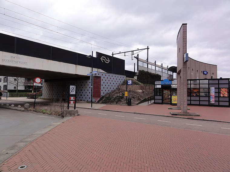
Photo: Havang(nl), CC0.
Nijmegen Dukenburg is a railway station located in the south west of Nijmegen, Netherlands. The station was opened on 2 June 1973 and is located on the Tilburg–Nijmegen railway. Nijmegen Dukenburg railway station is situated 1¼ km southwest of De Broederij.
Zwanenveld public library
Library

Photo: Havang(nl), CC0.
Zwanenveld public library is situated 1 km south of De Broederij.
Places in the Area
Nearby places include ‘t Broek and Lankforst.


Weurt
Village
Weurt is a village in the Dutch province of Gelderland. It is a part of the municipality of Beuningen, and lies about 0.1 km West of Nijmegen. Weurt was a separate municipality until 1818, when it was merged with Beuningen. Weurt is situated 3 km north of De Broederij.
De Broederij
- Type: Community center
- Address: Nieuwstadweg 37, Nijmegen, 6545AM
- Location: Nijmegen, Gelderland, Eastern Netherlands, Netherlands, Benelux, Europe
- View on OpenStreetMap
Latitude
51.83326° or 51° 49′ 60″ northLongitude
5.80216° or 5° 48′ 8″ eastOperator
Stichting De BroederijOpen location code
9F37RRM2+8VOpenStreetMap ID
node 2949344664OpenStreetMap feature
amenity=community_centre
This page is based on OpenStreetMap, Wikidata, and Wikimedia Commons.
We’d love your help improving our open data sources. Thank you for contributing.
Satellite Map
Discover De Broederij from above in high-definition satellite imagery.
Places with the Same Name
Discover other places named “De Broederij”.
Notable Places Nearby
Highlights include Kerk van de Nazarener and Sportzaal Gildekamp.
Nearby Places
Explore places such as Wellenkamp/Hoefkamp and De Geldersche.
Gelderland: Must-Visit Destinations
Delve into Arnhem, Apeldoorn, Ede, and Zutphen.
Curious Community Centers to Discover
Uncover intriguing community centers from every corner of the globe.
About Mapcarta. Data © OpenStreetMap contributors and available under the Open Database License". Text is available under the CC BY-SA 4.0 license, except for photos, directions, and the map. Photo: Agnes Monkelbaan, CC BY-SA 4.0.