Lärchegg - Monte Làrice
Lärchegg - Monte Làrice is a peak in Cornedo all’Isarco/Karneid, South Tyrol, Trentino-Alto Adige and has an elevation of 1,303 metres. Lärchegg - Monte Làrice is situated nearby to the locality Kaserbild, as well as near the village Steinegg.| Tap on a place to explore it |
Places of Interest
Highlights include Castle Steinegg and Karneid Castle.

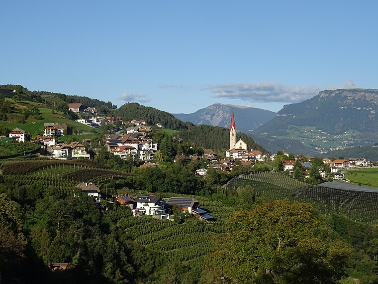
Karneid Castle

Photo: Wikimedia, CC BY-SA 3.0.
Karneid Castle is a castle in northern Italy situated in the comune of Karneid in the province of South Tyrol in the Italian region Trentino-Alto Adige/Südtirol, located about 4 km east of the city of Bolzano.

Places in the Area
Nearby places include Bolzano and Steinegg.
Bolzano

Photo: Italo-Europeo, CC BY-SA 3.0.
Bolzano or Bozen, is the capital city of South Tyrol, the German-speaking region in the northern part of Italy. Bolzano is the largest city in the region.

Lärchegg - Monte Làrice
- Type: Peak with an elevation of 1,303 metres
- Category: landform
- Location: Cornedo all’Isarco/Karneid, South Tyrol, Trentino-Alto Adige, Northeast Italy, Italy, Europe
- View on OpenStreetMap
Latitude
46.4763° or 46° 28′ 35″ northLongitude
11.4327° or 11° 25′ 58″ eastElevation
1,303 metres (4,275 feet)Open location code
8FRHFCGM+G3OpenStreetMap ID
node 2971356642OpenStreetMap feature
natural=peak
This page is based on OpenStreetMap, Wikidata, and Wikimedia Commons.
We’d love your help improving our open data sources. Thank you for contributing.
Satellite Map
Discover Lärchegg - Monte Làrice from above in high-definition satellite imagery.
In Other Languages
From German to Italian—“Lärchegg - Monte Làrice” goes by many names.
- German: “Lärchegg”
- Italian: “Monte Làrice”
Localities in the Area
Explore places such as Kaserbild and St. Veit - S. Vito.
Notable Places Nearby
Highlights include Mortner Gufl and Raketen-Baumhaus.
South Tyrol: Must-Visit Destinations
Delve into Bolzano, Brixen, Merano, and Bruneck.
Curious Peaks to Discover
Uncover intriguing peaks from every corner of the globe.
About Mapcarta. Data © OpenStreetMap contributors and available under the Open Database License". Text is available under the CC BY-SA 4.0 license, except for photos, directions, and the map. Photo: Benreis, CC BY 3.0.